Experience that matters
A Digital Land Survey Company More than Thousands of projects were successfully completed all over the country. More than five hundred clients are being served through Sonar Bangla Survey Consultants.
Featured Projects As Digital Lands Survey Company

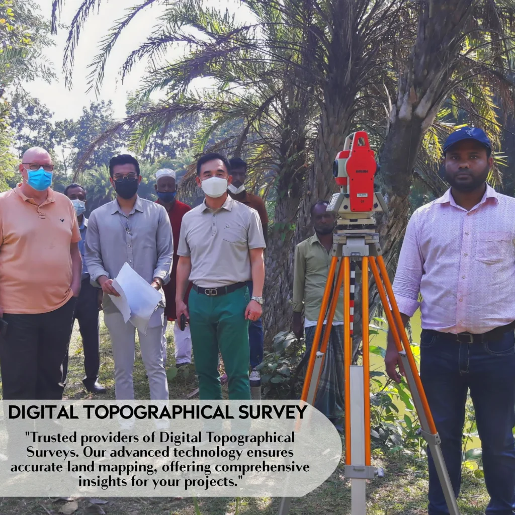

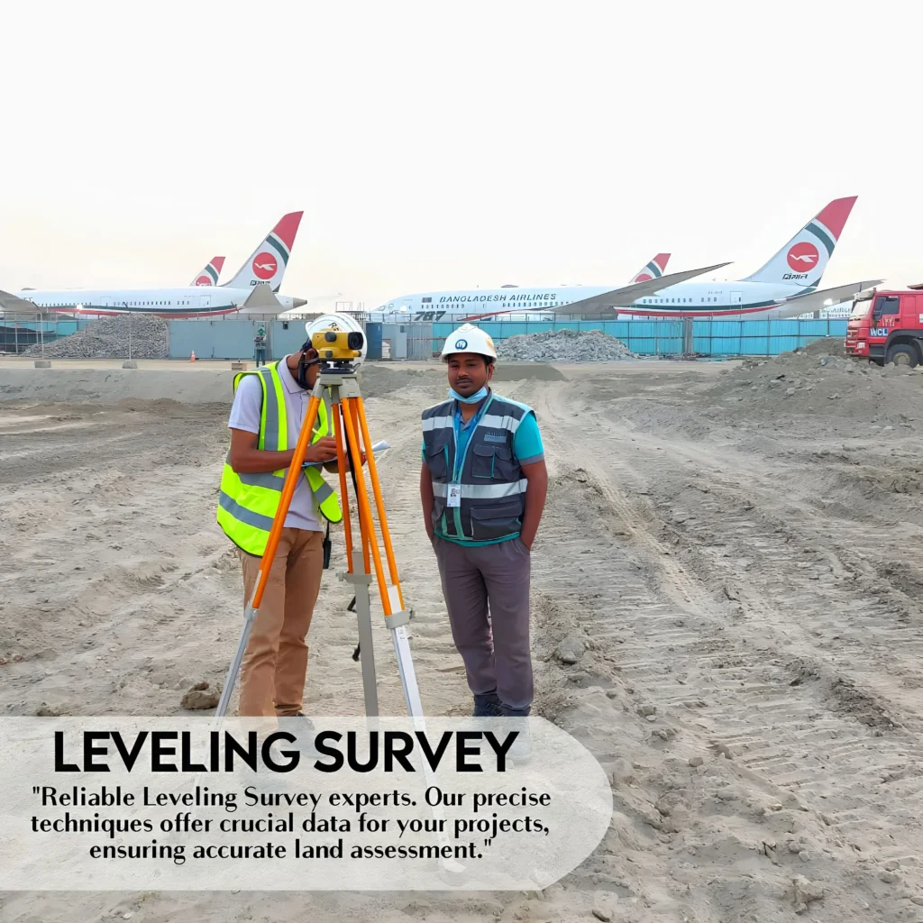
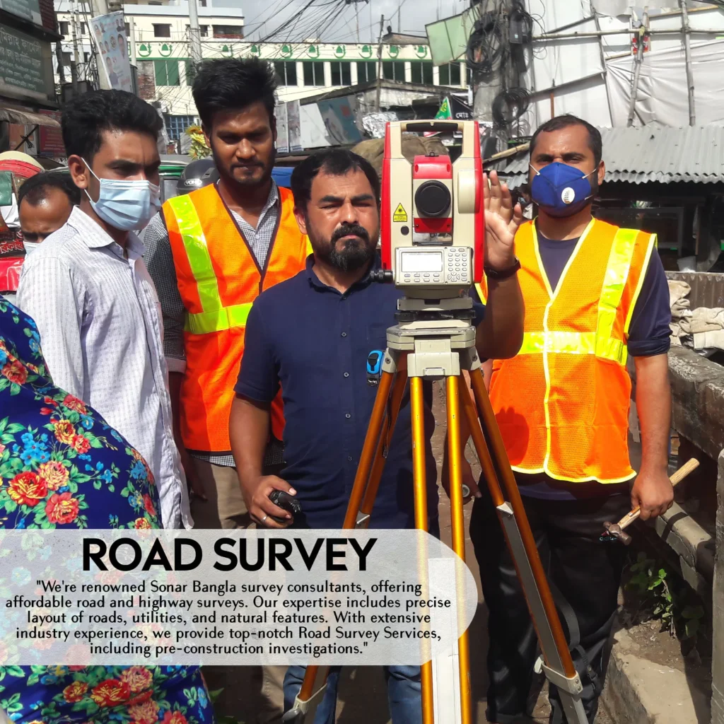
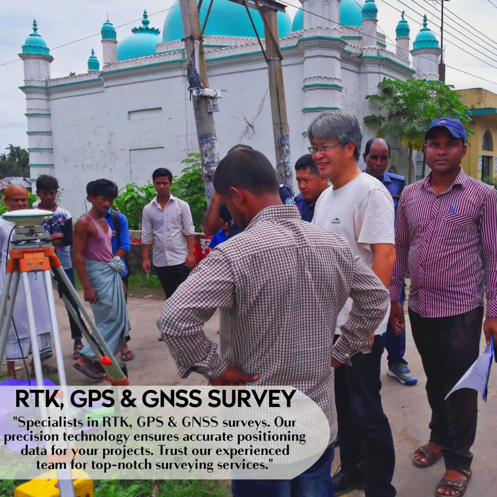
DRONE SURVEY BANGLADESH WATER DEVELOPMENT BOARD NARAIL
ROOPPUR NUCLEAR POWER PLANT PROJECT
32 MWac Grid Tied Solar PV Power Plant PROJECT
ROOPPUR NUCLEAR POWER PLANT PROJECT
DESIGN AND BUILD RE- CONSTRACTION OF EASTERN TRUNK MAIN (PACKAGE NO- WD-2)
CHATTOGRAM-COX’S BAZAR HIGHWAY IMPROVEMENT PROJECT
DHAKA ELEVATED EXPRESSWAY PROJECT
PAYRA POWER PLANT PROJECT PATUKHALI
BANSHKHALI POWER PLANT PROJECT
JAMUNA RAILWAY BRIDGE CONSTRUCTION PROJECT
DEPARTMENT OF ICT, CHITTAGONG PROJECT
MEGHNA RIVER HYDROGRAPHIC SURVEY PROJECT
PAYRA BRIDGE PROJECT
BASUNDHARA CITY DEVELOPMENT LIMITED – 03
PABNA-NATORE- SIRAJGONJ DISTRICT IRRIGATION DEVELOPMENT THROUGH SURFACE WATER PROJECT (BADC)
DHAKA AIRPORT PROJECT
DRONE SURVEY BANGLADESH WATER DEVELOPMENT BOARD NARAIL
BANDARBAN PROJECT
DHAKA AIRPORT PROJECT
BANDARBAN PROJECT


strategi aliances
Owned partners as Digital Lands Survey Company
We work with different types of organizations like…..
- Public Agencies
- Engineering Firms
- Private Contractors
- Architects and
- Land Owners
And we owned some ultimate partner as Land Survey Company.
A Digital Land Survey Firm with Digital Expertise
Additionally, A Digital Land Survey Company In an era where Accuracy and Effectiveness define success. Similarly our Survey Company emerges as a beacon of Creativity, Transforming traditional Evaluating methods through Advanced technology.
Just As industry leaders, we bring a Effortless blend of Proficiency and digital prowess to Reshape how we Discern and execute land surveys
.
Why Choose Our a Digital Land Survey Services?
Precision Redefined:
Moreover Our advanced digital tools, including GPS systems, drones, and laser Browsing devices, empower us to capture data with Incomparable Precision. Specifically surveys ensure that every inch of your land is Thoroughly mapped and Examined.
Efficiency Unleashed A Digital Land Survey:
A Digital land survey Accelerate the data collection process, Permitting us to cover Pervasive areas in record time. Furthermore This not only Hastens project Chronology but also Interprets into cost savings for our clients.
Data Transformed into Insights:
Thus Leveraging Cutting-edge Geographic Information System (GIS) Programs, we convert raw survey data into Feasible Awareness.
But also This enables us to create Thorough reports, Elaborate Topographical maps, and conduct Detailed spatial Scrutinies.
Tailored Solutions for Every Project:
However Whether your endeavor is in construction, development, or environmental assessment. Likewise our surveying solutions are customizable to meet the unique demands of your project.
No two projects are alike, and our adaptability ensures optimal results every time.
Secure, Confidential Operations:
Similarly We prioritize the security of your data. Rigorous measures are in place to safeguard the confidentiality of the sensitive information gathered during a digital land survey.
Future-Ready Approach:
At the forefront of technological advancements, we consistently upgrade our tools and methodologies. But Also Embracing the future of land surveying, our company ensures that our clients benefit from the most innovative and reliable services available.
Embrace the Future with Us
In a digital age where accuracy is paramount, our Survey Company stands as your trusted partner. Elevate your projects with precision, efficiency, and a forward-thinking approach.
Therefore Collaborate with us for a surveying experience that transcends boundaries and defines excellence. Explore the possibilities that digital lands surveying unlocks for your ventures.
| S.L NO | Units | Clients | Consultants | |
| S.L NO. 01 | Digital Topography & Contour Survey ,at Anggarjur, Beanibazar,Sylhet. | 93.00 Bigha | Kushiyara Auto Bricks Ltd. | |
| S.L NO. 02 | Digital Topography Survey & Cross Section at Square to Modena Market Point, Sylhet. | 10.850 km. | Joney Enterprise Ltd. | Sylhet City Corporation (SCC) |
| S.L NO. 03 | Digital Topography & Contour Survey at Uttar Hazipur (BALABARI) Tara Ganj, Rangpur. | 12.676 Bigha | ARISTOCRAT Builders Ltd. | |
| S.L NO. 04 | Interior Digital Topographic Survey at 22/58 Kanchpur, Sonargaon, Narayangonj,Dhaka. | 2.6 Bigha | Esquire Group | |
| S.L NO. 05 | Digital Topography & Contour Survey at Barasur, Kashiani, Gopalgonj. | 315.55 Bigha | Rumi Fish Feed Industries Ltd. | |
| S.L NO. 06 | Interior Digital Topographic Survey at Dhaka- Mymensingh Hwy Road. | 3.5 Bigha | Fu-Wang Ceramic Industry Ltd. | |
| S.L NO. 07 | Route Survey & GPS Survey from Jigatola to Dhaka Uddan 132/33 kv Line | 5.751 km. | BNF Engineers Ltd. | LS CABLE & SYSTEM LTD. |
| S.L NO. 08 | Digital Topography Road Survey from Chakrampur GC to Kalirbazar GC Road. At Trisal, Mymensingh. | 11.710 Km. | Local Government Engineering Debartment (LGED) | |
| S.L NO. 09 | Digital Topography & Contour Survey at Gochinga, Sreepur, Gazipur | 37.325 Bigha | Anoara Knit Composite Limited | CIVICON ENGINEERING |
| S.L NO. 10 | Route Survey & GPS Survey from PurbachalPGCB toBananiDesco Substation 132 kv Line. | 15.850 Km. | BNF Engineers Ltd. | LS CABLE & SYSTEM LTD. |
| S.L NO. 11 | Details Digital Topographical Land Survey,DigitizedMap,GPS& Leveling Survey at Savar, Dhaka. | 37.169 Bigha | C.R.P. AUTHORITY | |
| S.L NO. 12 | Digital Topography & Contour Survey at Adamjeenagar, Siddirganj, Narayanganj. | 3.4 Bigha | Checkpoint Systems Bangladesh Ltd. | ENGINEERS CONSORTIUM LIMITED |
| S.L NO. 13 | Column/ Pile Layout Per Drawings at Plot-1/B, Road-51, Gulshan-2, Dhaka. | N/A | Business DEAL | |
| S.L NO. 14 | Column/ Pile Layout Per Drawings at Anggarjur, Beanibazae, Sylhet. | N/A | Kushiyara Auto Bricks Ltd. | |
| S.L NO. 15 | Digital Topography & Contour Survey at Nagori Kaliganj, Gazipur, Bangladesh. | 23.500 Bigha | PURBACHAL APPAREL LIMITED. | Univend Structural Steel Ltd. |
| S.L NO. 16 | Digital Topography & Contour Land Survey at Sreemangal, at Moulvi Bazar | 4.6 acre | Space Architecture Engineer Ltd. | |
| S.L NO. 17 | Route Survey& Contour Survey, GPS Survey, GIS Map from PurboSadipur to Barapukuria | 58.45 Km. | Power Grid Company of Bangladesh (PGCB) | |
| S.L NO. 18 | 132kv Transmission Line Survey, Topography Survey, Contour Survey ,GPS Survey from Madaripur to Gopalganj at Madaripur. | 43.863 Km. | Power Grid Company of Bangladesh (PGCB) | |
| S.L NO. 19 | Digital Topography & Contour Survey at Jatrabari Park, from Jatrabari, Dhaka. | 2.52 acre | Dhaka South City Corporation (DSCC) Zoon -05,Saydabad,Dhaka. | |
| S.L NO. 20 | Digital Topography Land Survey & Contour Survey,GIS MAP, and Earth Volume, Project Dhaka Central Jail from Keraniganj,Dhaka. | 37.53 acre | Public Works Department (PWD) | |
| S.L NO. 21 | Digital Topography Road Survey, Contour Survey GPS MAP, Earth Volume, Project Dhaka Central Jail from Keraniganj,Dhaka | 7.200 Km. | Public Works Department (PWD) | |
| S.L NO. 22 | Digital Topography Road Survey & Cross Section, Earth Volume, Project Jatrabari Circle to Spree Spree Mandir at Jatrabari, Dhaka. | 2.3 Km. | Dhaka South City Corporation (DSCC) Zoon -05,Saydabad,Dhaka | |
| S.L NO. 23 | Route Survey & GPS Survey from Kanchan Bridge to Banani Substation 132/33 kv Line | 15.25 Km | BNF Engineers Ltd. | LS CABLE & SYSTEM LTD. |
| S.L NO. 24 | Digital Topography Land Survey, Contour survey, GIS map and Earth Volume for Proposed Project at Rupgonj, Narayangonj. | 167.300 Bigha | Sumona Housing Ltd. | |
| S.L NO. 25 | Route Survey & GPS Survey from Chankhar Pul to Hatir jheel Substation 132/33 kv Line. | 14.700 Km. | BNF Engineers Ltd. | LS CABLE & SYSTEM LTD. |
| S.L NO. 26 | Route Survey & Long Profile, GPS Survey from Kamrangirchar Substation to Zigatola Substation 132/33 kv Line. | 8.900 Km. | BNF Engineers Ltd. | LS CABLE & SYSTEM LTD. |
| S.L NO. 27 | Route Survey & GPS Survey from Purbachal PGCB to Banani Desco Substation 132 kv Line. | 15.850 Km. | BNF Engineers Ltd. | LS CABLE & SYSTEM LTD. |
| S.L NO. 28 | Column/ Pile Layout Per Drawings at Plot-1/B, Road-51, Gulshan-1, Dhaka. | N/A | Business DEAL | |
| S.L NO. 29 | Details Digital Topographical Land Survey,Digitized Map,GPS & Leveling Survey at Savar, Dhaka. | 37.169 Bigha | C.R.P. AUTHORITY | |
| S.L NO. 30 | Route Survey & GPS Survey from Jigatola to Dhaka Uddan 132/33 kv Line. | 5.751 km. | Public Works Department (PWD ) | |
| S.L NO. 31 | Digital Topography Land Survey, Contour survey, GIS map and Earth Volume for Proposed Project at Central Jail Keraniganj. | 471.200 Bigha | Public Works Department (PWD) | |
| S.L NO. 32 | Digital Topography & Contour Survey at Nagori Kaliganj, Gazipur, Bangladesh. | 23.500 Bigha | PURBACHAL APPAREL LIMITED. | Univend Structural Steel Ltd. |
| S.L NO. 33 | Digital Topography & Contour Land Survey at Sreemangal, at Moulvi Bazar | 4.6 acre | Space Architecture Engineer Ltd. | |
| S.L NO. 34 | Route Survey& Contour Survey ,GPS Survey,GIS Map from Purbo Sadipur to Barapukuria | 45.45 Km. | Power Grid Company of Bangladesh (PGCB) | |
| S.L NO. 35 | Digital Topography Land Survey & Contour Survey, GPS Survey at Habiganj, Sylhet. | 41.500 Bigha | Squire Group | |
| S.L NO. 36 | Building Column/ Pile Layout Per Drawings at Konabari Road,Gajipur. | N/A | Business DEAL | |
| S.L NO. 37 | Digital Topography Land Survey, Contour survey, GIS map and Earth Volume (primary school ) at Bhola | 526.200 Bigha | Local Government Engineering Department ( LGED ) | |
| S.L NO. 38 | Digital Topography Bazar Survey, Contour survey,GPS Survey, GIS map,( Bazar Survey ) at tala upazila, satkhira. | N/A | Local Government Engineering Department( LGED ) | |
| S.L NO. 39 | Building Column/ Pile Layout Per Drawings at Habigang Bypass Road Sylhet. | N/A | Magnum Engineering & Construction Ltd. | Squire Group |
| S.L NO. 40 | Digital Topography Land Survey, Contour survey, GIS map and Earth Volume for Proposed Project at Gazipur For Mayor Mojibur Rahman. | 7 Bigha | Mayor Mojibur Rahman | |
| S.L NO. 41 | Building Column/ Pile Layout Per Drawings at Jessore | N/A | NSC International | |
| S.L NO. 42 | Building Column/ Pile Layout Per Drawings at Pabna | N/A | Squire Group | |
| S.L NO. 43 | Digital Land Survey for Proposed Brick Field Project at Naogaon, | 9.600 Bigha | Bangladesh For MBF Briks | |
| S.L NO. 44 | Digital Topography Land Survey, Contour survey, GIS map and Earth Volume for Proposed Project at Patuakhali | 46.500 Bigha | Levu Khali Auto Bricks | |
| S.L NO. 45 | Route Survey,& GPS Survey from Khalispur Power House To Khulna South Sub-Station for JV China National Electric Wire & Cabule Lmp/. Corporation & Jiangsu, | 15.400 Km. | Corporation & Jiangsu | |
| S.L NO. 46 | Digital Topography Survey,GPS Survey, & Cross Section at Square to Modina Market Point , Sylhet. | 12.850 km. | Dhaka Designer | Sylhet City Corporation (SCC) |
| S.L NO. 47 | Route Survey & GPS Survey from Manik Nagor Sub-Station to 132/33 kv Line | 7.700 Km. | BNF Engineers Ltd. | LS CABLE & SYSTEM LTD. |
| S.L NO. 48 | Building Column/ Pile Layout Per Drawings at Dinajpur | N/A | BNF Engineers Ltd. | |
| S.L NO. 49 | Digital Topography Road Survey,GPS Survey, & Cross Section at to , Siri Siri Mandir | 167.300 Bigha | Sumona Housing Ltd. | |
| S.L NO. 50 | Digital Topography Canal Survey & Road Survey,GPS Survey, & Cross Section at Damra Road to Buriganga River | 15 .300 Km. | Dhaka South City Corporation Zone-05 (DSCC) | |
| S.L NO. 51 | Digital Topography Land Survey, Contour survey, GIS map and Earth Volume for Proposed Project at Rupshi, Rupganj ,Narayanganj for | 47.300 Bigha | Islam Group | |
| S.L NO. 52 | Digital Topography Land Survey, Contour survey , Building Column/ Pile Layout Per Drawings at Dinajpur | N/A | Business DEAL | |
| S.L NO. 53 | Digital Topography Land Survey, Contour survey, GIS map and Earth Volume for Proposed Project & Demarcation Layout at Patiya Chattogram. | 130.300 Bigha | Md.Motaleb Gong | |
| S.L NO. 54 | Building Column/ Pile Layout Per Drawings at Khulna | N/A | ENGINEERS CONSORTIUM LTD. | |
| S.L NO. 55 | Digital Topography Land Survey, Contour survey, GIS map and Earth Volume for at Gajipur | 25.300 Bigha | Md. Monirul Islam | |
| S.L NO. 56 | Digital Topography Road Survey,GPS Survey, & Cross Section at Jatra Bari to Kismat Market | 4.00 Km. | Dhaka South City Corporation Zone-05 (DSCC) | |
| S.L NO. 57 | Digital Topography Road Survey,GPS Survey, & Cross Section at Jatra Bari to Mannan High School and College | 2.400 Km. | Dhaka South City Corporation Zone-05 (DSCC) | |
| S.L NO. 58 | Digital Topography Road Survey,GPS Survey, & Cross Section at Jatra Bari to Jurain | 2.700 Km. | Dhaka South City Corporation Zone-05 (DSCC) | |
| S.L NO. 59 | Digital Topography Survey, Contour Survey, river cross section,GPS map, mouza map Survey, and Earth Volume for Project at Bagerhat Khulna. | 117.200 Bigha | Roads and Highways Department ( RHD ) | |
| S.L NO. 60 | Digital Topography Road Survey,Bridge Survey, Contour Survey, GPS MAP, Earth Volume, river cross section,GPS map, mouza map Survey, Project at Sylhet king Bridge to Sutarkandi Border | 43.300 Km. | Roads and Highways Department ( RHD ) | HIFAB International Pty. Ltd. |
| S.L NO. 61 | Digital Topography Survey & Road Survey,GPS Survey, & Cross Section at Uttara | 10.600 Km | Dhaka North City Corporation Zone-01 (DNCC) | |
| S.L NO. 62 | Building Column/ Pile Layout Per Drawings at Omc Bazar ,Gajipur | N/A | Business DEAL | |
| S.L NO. 63 | Building Column/ Pile Layout Per Drawings at Dinajpur | N/A | Rahman Ckemicals Limited | |
| S.L NO. 64 | Digital Topography Road Survey & ,GPS Survey, & Cross Section at Mirpur | 13.600 Km | Dhaka Water Supply Authority (WASA ) | |
| S.L NO. 65 | Digital Topography Land Survey, Contour survey, GPS map and Earth Volume for at Sonargaon, Narayangonj | 79 Bigha | Eng.Abul Kalam Azad | |
| S.L NO. 66 | Digital Topography Land Survey, Contour survey, GPS map and Earth Volume for at Madonpura,Gajipur | 18.300 Bigha | DHAKA DESIGNER | |
| S.L NO. 67 | Digital Topography Land Survey, Contour survey, GPS map and Earth Volume for at Rampura Kaca Bazar | 35.300 Katha | TRINITY` REAL STATE LTD. | |
| S.L NO. 68 | Digital Topography Road Survey & ,GPS Survey, & Cross Section at Mohammadpur | 11.500 Km | Dhaka North City Corporation Zone-05 (DNCC) | |
| S.L NO. 69 | Digital Topography Land Survey, Contour survey, GPS map and Earth Volume for at Beanibazar,Sylhet | 18.300 Bigha | Md.Motiur Rahman | |
| S.L NO. 70 | Digital Topography Land Survey, Contour survey, GPS map and Earth Volume for at Uttar Hazipur(Balabari), Taraganj, Rangpur | 12.676 Bigha | ARISTOCRAT Builders Ltd. | |
| S.L NO. 71 | Interior Digital Topographic Survey at 22/58 Kanchpur, Sonargaon, Narayangonj,Dhaka. | 2.6 Bigha | Esquire Group | |
| S.L NO. 72 | Digital Topography & Contour Survey,GIS map at Barasur, Kashiani, Gopalgonj. | 105 Acre | Rumi Fish Feed Industries Ltd. | CSD Engineering Limited |
| S.L NO. 73 | Interior Digital Topographic Survey at Dhaka- Mymensingh Hwy Road. | 3.5 Bigha | Fu-Wang Ceramic Industry Ltd. | |
| S.L NO. 74 | Digital Topography & Contour Survey at Gochinga, Sreepur, Gazipur. | 37.325 Bigha | Anoara Knit Composite Limited | CIVICON ENGINEERING |
| S.L NO. 75 | Digital Topography & Contour Survey at Adamjeenagar, Siddirganj, Narayanganj. | 3.4 Bigha | Checkpoint Systems Bangladesh Ltd. | |
| S.L NO. 76 | Digital Topography Road Survey from Chakrampur GC to Kalirbazar GC Road. At Trisal, Mymensingh. | 11.710 Km. | Local Government Engineering Debartment (LGED) | |
| S.L NO. 77 | Digital Topography Survey & Contour Survey,GIS map at Gagipur. | 90.720 Bigha | Venessa Enterprise Ltd. | DHAKA DESIGNER ASSET MANAGEMENT LIMITED |
| S.L NO. 78 | Transmission Line Survey, Topography Survey, Contour Survey ,GPS Survey from Ower Shifting Project Rajuk Jhilmil Project,Tower no-07 to Tower-15, | 2235.841m. | Power Grid Company of Bangladesh (PGCB) | |
| S.L NO. 79 | Building Column/ Pile Layout Per Drawings at Adamjeenagar,Siddirgang, Narayanganj-1431. | N/A | Checkpoint Systems Bangladesh Ltd. | CSD Engineering Limited |
| S.L NO. 80 | Digital Topography Road Survey & Long Profile, Gulshan | 7.200 Km | Dhaka Water Supply Authority (WASA ) | |
| S.L NO. 81 | Digital Topography Survey & Contour Survey,GPS map at South Panjora,Ward #05, Nagori Kaliganj,Gazipur bangladesh. | 30.00 Katha | PURBACHAL APPAREL LIMITED. | |
| S.L NO. 82 | Digital Topography Survey & Contour Survey,GPS map at | 5.00 Bigha | Bangladesh Parjatan Corporation ( BPC ) | |
| S.L NO. 83 | Digital Topography Land Survey, Contour survey, GPG map and Earth Volume for Proposed Project at Patenga Sea Beach, Chattagram | 96.300 Bigha | Bangladesh Parjatan Corporation ( BPC ) | |
| S.L NO. 84 | Floor Area Survey of 06th Storied | 06 nso. | Dil Afroz Begum | |
| S.L NO. 85 | Building Column/ Pile Layout Per Drawings at Kolapara ,Patuakhali | Saurav Das | ||
| S.L NO. 86 | Digital Topography Land Survey, Contour survey, GPG map and Earth Volume at Mouza –Joar Lakkhipur, Belbo,Norsindhi. | 9.563 Bigha | R R P FIDDM MILL LTD. | |
| S.L NO. 87 | Digital Topography Land Survey, Contour survey, GPG map and Earth Volume At Churhal Bazar,Sadar Mymensingh-2200 | 31.450 Katha | S.ALAM DESIGN & CONSTRUCTION LTD. | |
| S.L NO. 88 | 132kv Transmission Line Survey, Topography Survey, Contour Survey ,GPS Survey from Mostafapur to Gopalganj | 43.400 Km. | Power Grid Company of Bangladesh (PGCB) | |
| S.L NO. 89 | Column/ Pile Layout Per Drawings ,Floor Level, How to Check Level of Shuttering Slab Casting at Konabari,Gajipur. | N/A | Business DEAL | |
| S.L NO. 90 | Digital Topography Road Survey,Level Survey, & Cross Section at (01) Nandipar Bazar to Trimohini Bazar to (2) Balur par to Kayes Para,Khilgaon,Dhaka. | 6.200 Km. | Dhaka South City Corporation Zone-03 (DSCC) | |
| S.L NO. 91 | Column/ Pile Layout Per Drawings Chttogram | N/A | ENGINEERS CONSORTIUM LTD. | |
| S.L NO. 92 | Digital Topography Land Survey, Contour survey, GPG map and Earth Volume at Baridhara-DOHS | 192.300 Bigha | VOLUMATRIX LIMITED | |
| S.L NO. 93 | Column/ Pile Layout Per Drawings Mc Bazar, Gazipur. | N/A | Maghna Composite | |
| S.L NO. 94 | Digital Topography Land Survey, Property Layout, Contour survey, GPG map and Earth Volume at Bashundhara, Vatara. | 10.563 Bigha | Md.Shahidul Islam | |
| S.L NO. 95 | Digital Topography Land Survey,Property Layout, Contour survey, GPG map and Earth Volume at Administrative Area Agargoan sher-e-Bangla Nagar. (W-25) Muktijoddha Jadugar in Front | 12.563 Bigha | Dhaka North City Corporation Zone-05 (DNCC) | DevConsultants limited |
| S.L NO. 96 | River Cross Section, Pre-Work & Post Work at Project Name- Charal Kata Jomunessori Nadi, Nilphamari | 25.00 Km. | Bangladesh Water Development Board ( BWDB ) | |
| S.L NO. 97 | Digital Topography Land Survey,Property Layout, Contour survey, GPG map and Earth Volume at Administrative Area Agargoan sher-e-Bangla Nagar. (W-23) ICT in Front | 10.700 Bigha | Bangladesh Water Development Board ( BWDB ) | |
| S.L NO. 98 | Digital Topography Land Survey, Contour survey, GPG map and Earth Volume at Khatian No- RS-2838 J.L-75, Mouja-Somrasherabad,Noyakhali Lakshimipur | 62.200 Katha | Nirman Prokoushal Upadesta Ltd | |
| S.L NO. 99 | Digital Topography Land Survey, Contour survey, GPG map and Earth Volume at Mouja-Bansa Nagor, Laxmipur. Dag-5019, Khotian No-8375 & 8376 | 41.00 Katha | Nirman Prokoushal Upadesta Ltd | |
| S.L NO. 100 | Column/ Pile Layout Per Drawings ,Floor Level, How to Check Level of Shuttering Slab Casting at Anggarjur, Beanibazae,Sylhet. | N/A | Kushiyara Auto Bricks Ltd. | |
| S.L NO. 101 | Pre-Work & Post-Work, Column/ Pile Layout Per Drawings ,Floor Level, How to Check Level of Shuttering Slab Casting at Patuakhali,Payra Nevi Cantonment . | N/A | Rabeya Enterprise Ltd. | |
| S.L NO. 102 | Digital Topography Land Survey ,Pre-Work & Post-Work, Column/ Pile Layout Per Drawings ,Floor Level, How to Check Level of Shuttering Slab Casting at Gulsan-02 | N/A | Business DEAL | |
| S.L NO. 103 | Digital Topography Land Survey ,Pre-Work & Post-Work, Column/ Pile Layout Per Drawings ,Floor Level, How to Check Level of Shuttering Slab Casting at Chittagong University Of Engineering & Technology ( CUET ) | ENGINEERS CONSORTIUM LTD. | BANGLADESH HI-TECH PARK AUTHORITY | |
| S.L NO. 104 | (A)Digital Topography Road Survey ,Pre-Work & Post-Work, Improvement & Construction of Road With Spacious Pipe Drain & Footpath at Uttara Sector-04,Shayesta Kha Avenue East end to Sector-06,Esha Kha Avenue (Package-W-07 ) | 10.200 Km. | Dhaka North City Corporation Zone-01 (DNCC) | DevConsultants limited |
| S.L NO. 105 | Digital Topography Road Survey , Pre-Work & Post-Work, (A) = Improvment Of Road, Drain, Footpath & Median from Mahaboob Morshed Sarani to Science Museum Gate at Administrative area Agargoan sher-e-Bangla Nagar. (B)= Fron Mahbub Morshed Sarani to RAB-2 office via Girls College at Muktijoddah Meseum cultural College at Agargoan Sher-E-Bangla Nagar. (C )Form Mahaboob Morshed Sarani to Social Welfare Adhaidaptor ( In front of pass Port office Road ) at Administrative Area Agargoan sher-E-Bangla Nagar. ( Package No W-30) | 17.00 Km | DevConsultants limited | DevConsultants limited |
| S.L NO. 106 | (A)Digital Topography Road Survey ,Pre-Work & Post-Work, Improvement Of Road,Drain,Footpath & Median Mahboob Morshed Sarani To Cultural College Via Islamic foundation at Administrative area Agargoan, Sher-E-Bangla nagor, Dhaka.W-23 | 21.587 Km. | Dhaka North City Corporation Zone-05 (DNCC) | DevConsultants limited |
| S.L NO. 107 | (A)Digital Topography Road Survey ,Pre-Work & Post-Work, Improvement Of Road, Drain, Footpath IMPROVEMENT OF ROAD INFRASTRUCTURE AND DRAINAGE SYSTEM OF NEWLY ADDED NASIRABAD, DAKHINGAON, DEMRA AND MANDA AREA | 12.00 Km. | Dhaka South City Corporation Zone-03 (DSCC) | |
| S.L NO. 108 | Digital Topography Land Survey, Pre-Work & Post-Work, Column/ Pile Layout Per Drawings, Floor Level, How to Check Level of Construction of 2-Storied packing expansion Project at Dogory, Mirjapur, Gazipur. | N/A | KDS Accessories Ltd. | Steel Task Limited |
| S.L NO. 109 | Digital Topography Road Survey, Level Survey, & Cross Section at (01)Development of Bypass Road From Demra Stuff Quarter to Latif Bawani Jute Mill Gate No.22 & Kamargoap Graveyard to Stuff Quarter.(02) Haji market to basabo | 7.375 Km. | Dhaka South City Corporation Zone-03 (DSCC) | |
| S.L NO. 110 | Digital Topography Road Survey, Level Survey, & Cross Section & Volume Calculation at Road development work from Dakshingao Union Nandipara Bridge from Taheri Madrasa Road Under Zirani Khal Neair Trimohoni Maine Road, Lane & By Lane (package No-05 ) 1 | 13.550 Km. | Dhaka South City Corporation Zone-03 (DSCC) | |
| S.L NO. 111 | Digital Topography Road Survey, Level Survey, & Cross Section & Volume Calculation at Package - 11, Development Of Road And Construction Deep Drain Under Dakhingaon Union From Nandipara Bridge To Demra Meradia Link Road,Nandipara Bridge To Mostamaji Mor,Nandipara Bridge To Tirimohoni Bridge Via Sheker Jaga. Newly Added Nasirabad, | 19.860 | Dhaka South City Corporation Zone-03 (DSCC) | |
| S.L NO. 112 | Digital Topography Road Survey & Cross Section & Volume Calculation at Bangladesh Inland Water Transport Authority.(BIWTA)Topographical Survey Construction Of Walkway and Bank Protection on Shibchar (Maynakata River) start point Sheikh hasina Bridge to Jaduarchar Bridge. | 13.600 Km. | Bangladesh Inland Water Transport Authority. (BIWTA) | |
| S.L NO. 113 | Digital Topography Land Survey ,Pre-Work & Post-Work,Volume Calculation 33/11KV,2X10/13.33 MVA, Sub-station survey,Tarakanda, Churkhai, Rahmatpur,Gabindapur ,Char Iswardia, Nabi Nagar, | 06 Nso | Bangladesh Power Development Board (BPDB) | |
| S.L NO. 114 | Digital Topography Survey & Contour Survey, Pre-Work & Post-Work,Volume Calculation GPS map at Ashuganj, B.Baria,Dhaka to sylhet highway side Project. | 36.00 Bigha | Bangladesh Power Development Board (BPDB) | |
| S.L NO. 115 | Digital Topography Survey & Contour Survey, Pre-Work &Volume Calculation GPS map, Construction of intake pump house at pre-sedimentation basin, river intake, 218 m3 Portable treatment Plant, pre-sedimentation tank, Boundary wall of SWTP.at Cox's Bazar city and surrounding areas(EAP/DPHE/W-11),Ukhya Cox Bazar. | 18.50 Bigha | SR Corporation & Solar Electro Bangladesh Ltd. | |
| S.L NO. 116 | Digital Topography Survey & Contour Survey, Pre-Work &Volume Calculation GPS map, Design, Supply, Install, Test, Commission, Operation & Maintenance of Faceal Sludge & Segreated Solid Waste Treatment Plant, Kutupalong, Ukhya, Cox bazar. | 7.0 Bigha | SR Corporation & Solar Electro Bangladesh Ltd. | |
| S.L NO. 117 | Digital Topography Land Survey, Contour survey, GIS map and Earth Volume, GPS Map, (primary school ) at Patuakhali & Barguna Distructs | 200 Nso. | Local Government Engineering Department ( LGED ) | |
| S.L NO. 118 | Digital Topography Land Survey, Contour survey, GIS map and Earth Volume, GPS Map, Dipu Office, Kandila, Dhaka Tangail Bypass, Tangail. | 17.400 Bigha | RENATA LIMITED. | |
| S.L NO. 119 | Digital Topography Land Survey & Contour Survey, Pre-Work & Post-Work, Volume Calculation GPS map, Column/ Pile Layout Per Drawings, Floor Level, How to Check Level of Construction & Soil Investigation at Rajbari Project | 105.500 Bigha | SR Corporation & Solar Electro Bangladesh Ltd. | ASXIS TECH Engineering Construction Consultant Service |
| S.L NO. 120 | (A)Digital Topography Road Survey ,Improvement of Roads and Construction of Drain and Foothpath at Niketon Housing Complex Road No-1,2,3,4,5,5/1,6,6/1 & Mosque Road Under (package No-20 ) | 07.600 Km. | Dhaka North City Corporation Zone-05 (DNCC) | DevConsultants limited |
| S.L NO. 121 | Permanent Bench Mark (BM) [Reference from SOB,PWD, pillar], Temporary Bench Mark (TBM) Topographic Survey bridge length/bridge width Abutment Wall, Wing Wall, Location of Pier Pile Cap, Girder, bridge top RL, Bridge Bottom RL, H.F.L and N.F.L Canal Cross Section Soil Test Layout Survey at Pabna | 5.00 Nso. | Local Government Engineering Department ( LGED ) | |
| S.L NO. 122 | Digital Topography Land Survey, Contour survey, GPS map and Earth Volume for at Mouchak Road, Mizmizi, Siddirgonj. Narayangonj, Dhaka. | 241.800 Bigha | Alam Soap Factory Ltd. | |
| S.L NO. 123 | Digital Topography Land Survey, Contour survey, GPS map, Pre-Work & Post-Work, and Earth Volume, Column/ Pile Layout Per Drawings ,Floor Level, How to Check Level of Shuttering Slab Casting at Nanpura,Gazipur,Dhaka. | 243.500 Bigha | Hongkong Shanghai Manjala Limited | |
| S.L NO. 124 | Digital Topography Land Survey, Contour survey, Mouza Map Survey, GPS map, Pre-Work & Post-Work, and Earth Volume at Kalibari Link Road, Pachrukhi, Araihazar. | 25.320 Bigha | Mithela Textile Industries Ltd. | |
| S.L NO. 125 | Column/ Pile Layout Per Drawings, Floor Level, How to Check Level of Shuttering Slab Casting at Kalibari Link Road, Pachrukhi, Araihazar. | N/A | Mithela Textile Industries Ltd. | |
| S.L NO. 126 | Column/ Pile Layout Per Drawings, Floor Level, How to Check Level of Shuttering Slab Casting at Gulshan-2 | N/A | Dekko Group | |
| S.L NO. 127 | Digital Topography Land Survey, Contour survey, GPS map, Pre-Work & Post-Work, and Earth Volume, Column/ Pile Layout Per Drawings ,Floor Level, How to Check Level of Shuttering Slab Casting at GobindaBari, Kasimpur. | 31.200 Bigha | Rich Cotton Limited | |
| S.L NO. 128 | Digital Topography Road Survey , Cross Section ,Pre-Work & Post-Work, Improvement of Roads & Construction of Drain Footpath at Tajgon Area at H/N:348/A to Chitdren family,Nakal Para 431/1to Tejgaon 416/1 to H/N:416/1 to Bg press,H/N: 360 to phonix Tower,H/N:248/3 to City Filling Station & H/N:403 to Central Medical Store. (Package No W-17),(Package No W-18). (Package No W-19). | 17.900 Km. | Dhaka North City Corporation Zone-03 (DNCC) | DevConsultants limited |
| S.L NO. 129 | Digital Topography Road Survey , Cross Section ,Pre-Work & Post-Work, Improvement of Roads & Construction of Drain & Footpath at Chad Uddan, Shopno Dhara Housing,Chandrima Model Town & Dhaka Uddan Under Ward no-33 Road.(Package No W-41) ,(Package No W-40). | 8.300 Km. | Dhaka North City Corporation Zone-03 (DNCC) | DevConsultants limited |
| S.L NO. 130 | Digital Topography Land Survey, Contour survey, Mouza Map Survey, GPS map, Pre-Work & Post-Work, and Earth Volume Column/ Pile Layout Per Drawings, at Shirir Chala, Bhabanipur, Bagher Bazar,Gazipur Shader,Gazipur. | N/A | Evince Textiles Ltd | |
| S.L NO. 131 | Column/ Pile Layout Per Drawings, Floor Level, How to Check Level of Shuttering Slab Casting at Kalibari Link Road, Pachrukhi, Araihazar. | N/A | Mithela Textile Industries Ltd. | |
| S.L NO. 132 | Digital Topography Land Survey, Contour survey, Mouza Map Survey, GPS map, Pre-Work & Post-Work, and Earth Volume at Gopalpur Panch Bibi , Joypurhat. | 52.500 Bigha | M/S Nivan Fisheries | |
| S.L NO. 133 | Digital Topography Land Survey, Contour survey, Mouza Map Survey, GPS map, Pre-Work & Post-Work, and Earth Volume Column/ Pile Layout Per Drawings, at Hazirbazar,Vhaluka. | 84.00 Bigha | Taipei Bangla Fabrics Ltd. | |
| S.L NO. 134 | Digital Topography Land Survey, Contour survey, Mouza Map Survey, GPS map, Pre-Work & Post-Work, and Earth Volume Column/ Pile Layout Per Drawings, at Gazipua. | N/A | china harbour engineering company bangladesh ltd | |
| S.L NO. 135 | Digital Topography Land Survey, Contour survey, Mouza Map Survey, GPS map, Pre-Work & Post-Work, and Earth Volume at Bhabanipur, Bagher Bazar,Gazipur Shader,Gazipur. | 48.300 Bigha | Evitex Dress Shirt Ltd. | |
| S.L NO. 136 | Column/ Pile Layout Per Drawings, Floor Level, How to Check Level of Shuttering Slab Casting at Beltiabari, Tangail. | N/A | Renata Limited | |
| S.L NO. 137 | Digital Topography Land Survey, Contour survey, Mouza Map Survey, GPS map, Pre-Work & Post-Work, and Earth Volume at Bhabanipur,Gazipur Shader,Gazipur. | 75.300 Bigha | Evitex Apparels Ltd. | |
| S.L NO. 138 | Digital Topography Land Survey, Contour survey, Mouza Map Survey, GPS map, Pre-Work & Post-Work, and Earth Volume at Beltiabari, Tangail. | 5.00 Bigha | Renata Limited | |
| S.L NO. 139 | Column/ Pile Layout Per Drawings, Floor Level, How to Check Level of Shuttering Slab Casting at Bhabanipur,Gazipur Shader,Gazipur. | N/A | Enam Labels Limited Factory | |
| S.L NO. 140 | Digital Topography Land Survey, Contour survey, GPS map, Pre-Work & Post-Work, and Earth Volume at Mymensingh. | Eight power substation (125.500 Bihga) | Bangladesh Power Development Board (BPDB) | |
| S.L NO. 141 | 132/33 Gride Sub-Station,Digital Topography Land Survey, Contour survey, GPS map, Pre-Work & and Earth Volume at Chawala, Narshindi. | 6.200 Bigha | Power Grid Company of Bangladesh (PGCB) | |
| S.L NO. 142 | Digital Topography Land Survey, Contour survey, Mouza Map Survey, GPS map, Pre-Work, Earth Volume at Narail. | 491.18 acre | Roads and Highways Department ( RHD ) | |
| S.L NO. 143 | Digital Topography Road Survey , Cross Section ,Pre-Work & Post-Work,Improvement Of Roads & Construction Of Drain & Footpath at Jatrabari Bailzuri Alakay Kartoon Factory South By The Sid Priyanka Cty Road Development Work Includin Paiplane (Package No W-41) ,(Package No W-51).,(Package No W-52). | 13.580 Km. | Dhaka North City Corporation Zone-06 (DNCC) (Harirampur) | DevConsultants limited |
| S.L NO. 144 | Digital Topography Road Survey , Cross Section ,Pre-Work &Post-Work, Improvement Of Roads &Construction Of Drain &Footpath at Baro Bot Tola Mhjer Koloni,Krishi Bank Road,Adorsho Para Road,Purvo Madartek Road,Bashabo Main Road,Demra-Meradia Link Road,Trimohoni Main Road,Aftab Uddin Goli,Josmiya Goli, | 19.800 Km. | Dhaka South City Corporation Zone-03 (DSCC) | |
| S.L NO. 145 | Digital Digital Topography Road Survey, Contour survey, Mouza Map Survey, GPS Map, Pre-Work,Drain & Footpath Earth Volume Etc at Narail. | 18.700 Km | Roads and Highways Department ( RHD ) | |
| S.L NO. 146 | Digital Topography Land Survey, Contour survey, Mouza Map Survey, GPS map, Pre-Work & Post-Work, and Earth Volume Column/ Pile Layout Per Drawings, at Hazirbazar,Vhaluka. | 824.00Bigha | Taipei Bangla Fabrics Ltd. | |
| S.L NO. 147 | Digital Topography Land Survey, Contour survey, Mouza Map Survey, GPS map, Pre-Work & Post-Work, and Earth Volume | 7.00 Bigha | Bombay Sweets & Co. Ltd. | |
| S.L NO. 148 | Digital Topography Land Survey, Contour survey, Mouza Map Survey, GPS map, Pre-Work & Post-Work, and Earth Volume. at Gazipur. | 15.500 Bigha | RAK Ceramics (BD) Limited | Zen Consultants Ltd. |
| S.L NO. 149 | Digital Topography Road Survey, Cross Section, Pipeline survey, Long Profile, Improvement of Road Drain & Footpath at Road No-73(bylane-1,2)79,81,82,85,113/A of Gulshan & Road no-4,21,23/B, of Bannani Under Ward No-19 DNCC | 7.300 Km | Dhaka North City Corporation Zone-03 (DNCC) | |
| S.L NO. 150 | Digital Topography Land Survey,Contour survey,Raw Materials Survey,(01) High Plastic Clay, (02) Semi Plastic, (03) Non Plastic, (04) Malaysian Feldsper, (05) Soda Feldsper, (06) Pyrophyllite, (07) Red clay, (08) Chitka Clay, (09) Modhupur Clay,(10) Silicon Sand, (11) Lime stone, Ashariar Char, Sonargaon, Narayanganj | N/A | Meghna Ceramic Industries Ltd. | |
| S.L NO. 151 | Digital Topography Road Survey, Cross Section, Pipeline survey, Long Profile,at Mirbag to Hawai Goli , Kodomtola Mor to Wasa Road, Manik Nagor Wasa Road to Shampur Wasa Road . | 12.300 Km | Dhaka Water Supply And Sewerage Authority (DWASA) | CHINA CIVIL ENGINEERING CONSTRUCTION CORPORATION (CCECC) |
| S.L NO. 152 | Column/ Pile Layout Per Drawings, Floor Level, How to Check Level of Shuttering Slab Casting at 58, DEPZ, Ganakbari, Saver, Dhaka. | N/A | Alfa Patterns (Bangladesh) Limited | |
| S.L NO. 153 | Digital Topography Land Survey, Contour survey, Mouza Map Survey, GPS map, Pre-Work & Post-Work, and Earth Volume. at joyna Bazar Sreepur, Gazipur. | 170.00 Bigha | Meghna Knit Composite ltd. | |
| S.L NO. 154 | Column/ Pile Layout Per Drawings, Floor Level, How to Check Level of Shuttering Slab Casting at 54 56 Export Processing Zone Ganakbari, Savar Union,Dhaka | N/A | Lenny Apparels Ltd. | |
| S.L NO. 155 | Column/ Pile Layout Per Drawings, Floor Level, How to Check Level of Shuttering Slab Casting at Plot- 98-100, Dhaka Export Processing Zone, 1349 , Savar Union,Dhaka. | N/A | Goldtex Garments Ltd |
