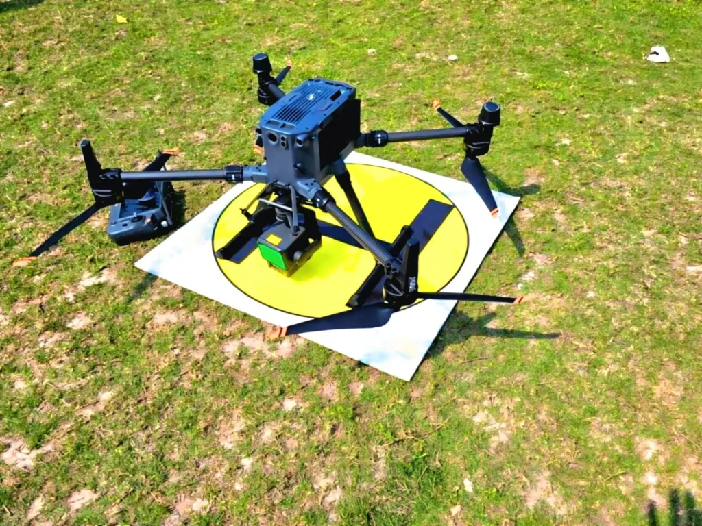
Best Drone Survey Company in Bangladesh
A drone survey uses drones to collect, analyze, and map land, infrastructure, and environmental areas with high accuracy. Equipped with advanced cameras and sensors, drones capture detailed images and 3D data using GPS and geospatial technology—making the process faster, safer, and more precise than manual methods.
Key Benefits:
Speed: Covers large areas quickly.
Accuracy: Delivers precise, high-quality data.
Access: Reaches remote or risky locations easily.
Cost-Effective: Cheaper than traditional surveying.
3D Mapping: Enables advanced analysis and visualization.
Drone surveying is now widely used in land surveying, urban planning, infrastructure, agriculture, forestry, and environmental monitoring across Bangladesh.
The Role and Importance of drone land surveying Before Starting a New Project
Drone surveys play a crucial role before starting a new project. By using drones, rapid and accurate data can be collected, which is essential for project planning, design, and implementation. Through drone surveys, critical information about land, infrastructure, water bodies, environmental conditions, and other relevant data is gathered, ensuring the accuracy and sustainability of the project.
Below are the roles and importance of drone surveys:
1. Rapid and Accurate Data Collection
Drone surveys can capture high-resolution images and videos over large areas in a short time. This facilitates faster and more precise data collection during preliminary surveys, helping in the correct planning of the project’s next stages.
2. Creation of 3D Maps and Models
Data collected from drones can be used to create three-dimensional (3D) maps, which assist in spatial analysis of the project area and future planning. These models are particularly useful for land development, road construction, and other infrastructure projects.
3. Environmental Analysis
Drones make it easier to analyse the environmental impact in the project area. Using sensors and cameras, drones can measure the quality of water, air, and soil, helping to determine the potential environmental effects of the project.
4. Assessment of Damage and Risks
Drone surveys are highly effective for analysing soil erosion, land changes, or the risk of future damages in the project area. This helps in planning maintenance strategies early on in the project.
5. Site Security and Monitoring
Ensuring site security before a project starts is a major challenge. Drone surveys help in monitoring and securing the site, identifying potential hazards and preventing unwanted accidents.
6. Cost and Time Management
Traditional methods of gathering site information are time-consuming and expensive. Drone surveys solve this issue by completing survey tasks faster and at a lower cost, increasing the likelihood of meeting project deadlines.
7. Monitoring Project Progress
After a project begins, drone surveys help in regularly monitoring the site’s progress. It’s an effective way to manage the project and verify its advancement.
8. Reducing Complexity and Risk
Drone surveys can easily operate in remote and hazardous areas, where human intervention is risky. This helps in reducing complexity and risk in the project.
Summary:
Using drone surveys before starting a new project plays an effective role in project planning, environmental analysis, and successful implementation. It is not only cost and time-saving but also reduces project risks and aids in informed decision-making.
The Role of best drone surveying for Large Plots
The role of drones in surveying large plots is extremely important and effective. Using drones, large land plots or areas can be surveyed quickly, accurately, and cost-effectively, making it a superior method compared to traditional approaches. Below are the key roles of drone surveys for large plots:
- Fast and Accurate Surveying
Drones enable rapid and precise surveying of large areas. High-resolution images and videos captured by drones can be analysed through software to create an accurate map of the plot. This is especially important for large plots, where manual surveying can be time-consuming and labour-intensive.
- Fast and Accurate Surveying
- Boundary and Area Determination
Drone surveys help in accurately determining the boundaries of large plots of land. This is crucial for resolving land ownership disputes and ensuring clear boundary demarcation, which is vital for large-scale plots.
- Boundary and Area Determination
- Creation of 3D Maps
Using data collected from drones, 3D maps of large plots can be created. These maps provide detailed insights into land elevation, slopes, and other geographical features, which are useful for construction, agricultural management, and land development.
- Creation of 3D Maps
- Cost and Time Efficiency
Manual surveys of large plots can be expensive and time-consuming. Drone usage reduces the time needed for surveying large plots and significantly cuts costs, making it particularly beneficial for agricultural, construction, and land development projects.
- Cost and Time Efficiency
- Surveying Remote and Hazardous Areas
Large plots often include remote or hazardous areas that are difficult to access. Drones can easily survey such areas, reducing the need for human presence and lowering the risk involved in the survey.
- Surveying Remote and Hazardous Areas
- Environmental and Land Analysis
Drones can monitor the environmental impact, soil erosion, water reservoirs, and air flow over large plots of land. Sensors and cameras equipped on drones make it easy to gather data for environmental analysis and efficient land management.
- Environmental and Land Analysis
- Regular Monitoring and Development Assessment
Drones can be used to regularly monitor the condition of large plots. During development projects, drones are highly effective in assessing project progress, allowing for rapid evaluation of ongoing work.
- Regular Monitoring and Development Assessment
Summary:
Drone surveys provide fast, accurate, and cost-effective solutions for large plots. With drones, determining precise boundaries, creating 3D maps, conducting environmental analysis, and monitoring development becomes easier. This leads to improved efficiency, reduced costs, and enhanced quality in survey operations.
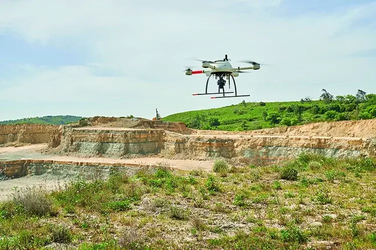
The Role of drone survey and Mapping
Architects can use drone mapping technology to create detailed 3D models of buildings before construction. Using drones for mapping offers many advantages over traditional methods such as satellite imagery or ground-based surveys. With cameras attached to drones, it is possible to capture precise images of specific areas. Drones are now widely used for surveys in various infrastructure projects. For example, commercial factories, mountainous roads, bridges, and dams can be easily mapped by flying drones over the entire plot before construction.
Environmental Monitoring: Drones assist in monitoring environmental changes such as deforestation, coastal erosion, and wildlife habitats. They provide essential data for conservation efforts and sustainable land management.
Aerial Photography and Videography: Drones can capture high-resolution images and videos from various heights and angles, providing detailed visual data for mapping and analysis.
Equipped with Light Detection and Ranging (LiDAR) sensors, drones can create precise 3D models of terrain, capturing elevation data and surface details. By capturing detailed elevation data, drones can produce accurate topographic maps, which are useful for construction planning, land development, and environmental studies.
In summary, drones offer a fast, precise, and cost-effective solution for surveying and mapping, providing essential data for various industries and projects.
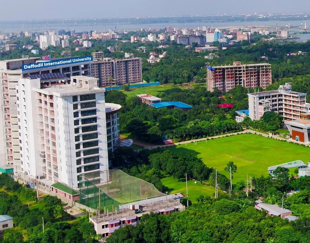
Role of drone land surveying Urban Planning and Infrastructure Development
Drones can quickly create 3D models of landscapes, buildings, and infrastructure, helping in urban planning, disaster management, and heritage preservation. They cover large areas faster and more affordably than traditional surveys, accessing hard-to-reach or risky locations safely. With frequent data collection, drones enable real-time monitoring of environmental and urban changes. Drone mapping supports accurate land surveys, construction, and engineering by providing precise topographic data for better planning and project development.
Below are the key roles of drone surveys in urban planning and infrastructure development:
- Rapid and Accurate Data Collection:
Drones can capture high-resolution images and videos of different parts of a city from above. This provides rapid and accurate data, which helps create precise maps of the city. Accurate and up-to-date data is essential for proper city planning and building construction.
- Rapid and Accurate Data Collection:
- Creation of 3D Models and Maps:
The data collected by drones can be used to create three-dimensional (3D) maps and models of the city. These models help in analysing the height, shape, and geographical features of different areas, which are crucial for building construction and infrastructure development.
- Creation of 3D Models and Maps:
- Saving Time and Costs:
Using drones to survey large urban areas is faster and more cost-effective. Where traditional methods require significant time and expenses, drones can collect data efficiently, making the process much more economical in terms of both time and cost.
- Saving Time and Costs:
- Accurate Planning for Infrastructure Development:
Information gathered through drones helps in precise planning for infrastructure development, such as roads, water supply, electricity, and drainage systems. Drone surveys provide vital information that enhances the quality and effectiveness of development projects.
- Accurate Planning for Infrastructure Development:
- Monitoring Roads and Transportation Systems:
Drone surveys play a significant role in monitoring and planning road and transportation systems in cities. The condition of roads, traffic congestion, and vehicle movement can be easily observed through drones, aiding in better city traffic planning and road development.
- Monitoring Roads and Transportation Systems:
- Environmental Analysis:
Drone surveys are essential in analysing the environmental impact of urban development projects. With drones, the air, water, and soil quality in a city can be monitored, helping in identifying environmental risks and taking appropriate action.
- Environmental Analysis:
- Regular Monitoring and Development Observation:
During urban development projects, drones can be used to monitor the site’s status regularly. This helps in evaluating the progress of the project and quickly resolving any issues that arise.
- Regular Monitoring and Development Observation:
Summary:
Drone survey technology provides rapid, accurate, and cost-effective solutions for urban planning and infrastructure development. Through this, it is possible to make the city’s planning, environmental analysis, and infrastructure development activities more precise and efficient, playing a crucial role in the city’s future development.

Effectiveness of Drone Survey
A drone survey is a modern method that uses drones, or unmanned aerial vehicles (UAVs), to collect images and data from above. This technology is highly effective for quickly and accurately mapping large areas, offering significant advantages over traditional land surveying methods. Equipped with high-resolution cameras and sensors, drones fly over survey sites, capturing hundreds of images and gathering data that can be processed to create detailed maps, 3D models, and other important information. Drones are particularly effective in areas that are difficult or dangerous for humans to access.
Drones can survey challenging and hazardous locations, such as mountainous regions, forests, and disaster zones, more safely and efficiently than manual methods. Additionally, drone surveys can be completed much faster and at a lower cost. Where traditional survey methods can be time-consuming and expensive, drone technology simplifies the process, saving both time and money.
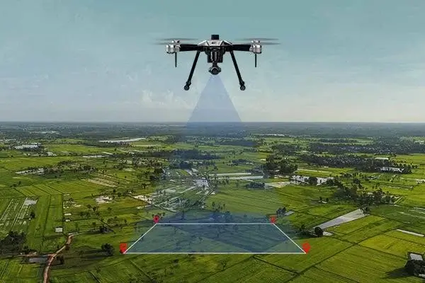
The Growing Importance of Drone Surveys in Modern Project Management in Bangladesh
Drone surveys play a crucial role in project management by providing fast, accurate, and cost-effective solutions for land and infrastructure projects. They are particularly useful for surveying areas that are difficult, remote, or hazardous for humans, large agricultural fields, forests, rivers, and coastal regions. By using drones, companies can save significant time and reduce costs while increasing accuracy and safety, making drone surveying an essential tool for industries like construction, agriculture, mining, urban planning, and environmental monitoring.
In Bangladesh, the Department of Land Records and Surveys has started implementing drone land surveys. After successful trials at Kuakata Sea Beach, a company was awarded a tender by the Ministry of Land to conduct drone surveys in Itabaria mouza of Sadar Upazila, Patuakhali. Following final evaluation, the survey work will expand to Sadar Upazila, Patuakhali, and Barguna, demonstrating the government’s growing focus on drone-based mapping for land development and project management.
Using drones, surveyors can capture high-resolution images, videos, and 3D mapping data rapidly, which is essential for accurate planning, design, and implementation of projects. Drone surveys allow monitoring of remote or dangerous areas safely, helping to identify hazards and implement safety measures in advance. Compared to traditional manual surveying methods, drone surveys are faster, more accurate, and cost-effective, reducing labor and overall project expenses significantly.
Benefits of Drone Surveys in Project Management:
Time Efficiency: Complete surveys faster than traditional methods.
High Accuracy: Collect precise data for planning and decision-making.
Cost-Effective: Lower labor and equipment costs.
Risk Management: Survey hazardous or remote areas safely.
3D Mapping & Analysis: Enable advanced spatial analysis for infrastructure, land development, and environmental projects.
In conclusion, drone surveys have become indispensable for modern project management in Bangladesh. By improving accuracy, reducing costs, ensuring safety, and providing detailed mapping and monitoring capabilities, drone surveying ensures the successful planning and execution of projects, making it an essential technology for the future of construction, urban planning, and environmental management.
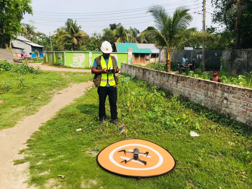 Best drone for surveying large-scale construction and infrastructure — professional drone surveying company providing precise mapping solutions.[/caption]
The Use of Drone Surveying for Large Areas
Drones have become an essential tool for surveying large areas, enhancing communication among construction participants, improving site safety, and enabling the precise topographic measurement of expansive regions. Through the principles of aerial photogrammetry, drones can conduct surveys for buildings, bridges, roads, highways, and industrial construction projects.
Survey drones create high-resolution Ortho mosaics and detailed 3D models in areas where low-quality, outdated, or even no data are available. They allow for the swift and easy creation of highly accurate cadastral maps, even in complex or hard-to-access environments. Drone solutions gather precise, geo-tagged data quickly, which photogrammetry software processes to deliver standardised outputs.
Key Uses of Drone Surveys for Large Areas:
- Rapid and Precise Data Collection
Drones are highly effective for surveying large areas such as agricultural lands, forests, coastal zones, or industrial regions. They fly quickly over large spaces, capturing high-resolution images and videos, delivering accurate and timely data much faster than traditional methods.
- Rapid and Precise Data Collection
- Project Monitoring and Development
Drones facilitate easy monitoring of construction projects, infrastructure development, and environmental changes. In large-scale areas, drone surveys assist in tracking project progress and supporting future planning.
- Project Monitoring and Development
- Creation of 3D Maps and Models
The data collected through drones can be used to create 3D maps of large areas. These models help analyse land elevation, slopes, and other geographical features, making it easier to plan and develop the area effectively.
- Creation of 3D Maps and Models
- Environmental Monitoring
Drones can monitor extensive areas to assess environmental conditions, such as deforestation, riverbank erosion, or the effects of climate change. Timely data collection through drones allows for continuous monitoring and helps take corrective action.
- Environmental Monitoring
- Emergency Management
In emergency situations like floods, fires, or earthquakes, drone surveys are extremely useful. Drones can quickly assess affected areas and provide necessary information, aiding rescue operations and risk management.
- Emergency Management
Conclusion:
Drone surveying offers a quick and cost-effective solution for surveying large areas, providing accurate data that saves time and money. Drones make it easier to monitor environmental changes, manage construction projects, and assess large regions efficiently, supporting improved planning and management.
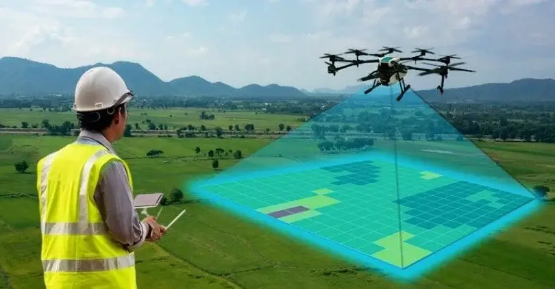
The use of drones for digital mapping of land has begun, providing accurate information.
According to Haryana Revenue Department’s ACS (Additional Chief Secretary), P.K. Das, the digital mapping of land properties will be created using drones, and then connected with GPS. The process of digital mapping using drones has already started. As the propellers spin, they push air molecules downward, lifting the drone upwards. Once in the air, the drone can move forward, backward, left, or right by adjusting the speed of each of the four propellers. By collecting multiple data points, it will be possible to gather accurate information about land size, including features like trees, ponds, buildings, semi-open structures, and tin-roofed houses.
Benefits of Drone-Assisted Digital Land Mapping:
- Accurate Information Collection
Drone surveys provide precise data on the shape, boundaries, and geographical features of the land. This helps in accurately determining the size and boundaries of land, which is crucial for resolving ownership and boundary disputes.
- Accurate Information Collection
- Fast and Efficient Surveying
Drones can quickly capture high-resolution images and videos of large areas. This is much faster and more efficient than traditional manual surveys, saving both time and cost.
- Fast and Efficient Surveying
- Creation of 3D Models
Using data collected by drones, three-dimensional (3D) maps of the land can be created. These models are useful for construction, project planning, and development, as they provide insights into the land’s elevation, slopes, and other topographical features.
- Creation of 3D Models
- Surveying Challenging or Dangerous Areas
Drones can easily survey areas that are difficult or dangerous for people to reach, such as rugged terrain, forests, or regions affected by natural disasters like floods.
- Surveying Challenging or Dangerous Areas
- Cost-Effective
Digital land mapping with drones allows for the collection of more data at a lower cost. In contrast to traditional methods that require extensive labour and expense, drone surveys are faster and more cost-efficient.
- Cost-Effective
Summary:
Using drones for digital mapping of land has made it easier to obtain accurate data. This method supports land development, construction planning, and boundary determination, aiding in effective decision-making and accelerating developmental activities.
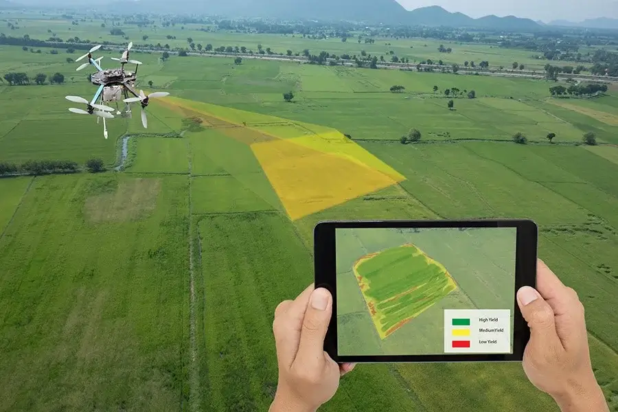
How Drones Assist in Topographic Surveys in Bangladesh
Drone surveys have revolutionized topographic mapping by providing fast, accurate, and cost-effective data collection. Modern drones can create 1:500 scale maps without Ground Control Points (GCPs) and achieve centimeter-level accuracy, producing Digital Orthophoto Maps (DOM), Digital Surface Models (DSM), and 3D models. Small teams can cover large areas quickly, making surveys faster and more efficient than traditional methods.
Drones also help monitor environmental changes like deforestation, river erosion, and land-use shifts. High-resolution images and 3D models assist in project planning, construction, and infrastructure development, improving safety and reducing costs.
Advantages of Drone Surveys:
High Accuracy: Detailed images and GPS-based positioning.
3D Mapping: Analyzes complex terrain for better planning.
Rapid Data Collection: Speeds up surveys and project timelines.
Cost & Risk Reduction: Safer and more affordable than manual surveys.
Limitations:
Limited battery life and flight time
Weather dependency (rain, wind, temperature)
Challenging terrains like dense forests or mountains
Regulatory restrictions on drone operations
Conclusion:
Drone surveys provide a modern, efficient, and accurate solution for topographic mapping, land development, and environmental monitoring. Despite some limitations, they save time, reduce costs, and improve project safety, making them essential for drone surveying in Bangladesh.
Do Drones Provide Environmental Information?
Drones can collect information on environmental factors such as air quality, noise levels, and soil erosion. This information helps professionals make informed decisions regarding construction practices and minimises the impact on the surrounding environment. Drones have revolutionised the survey process by providing accurate data, enhancing safety, and improving overall efficiency in construction and civil engineering projects. Drones are highly effective tools for gathering environmental data. They are equipped with high-tech cameras, sensors, and other equipment that can provide detailed information about various environmental changes and conditions. Below are some key areas where drones provide environmental information:
- Monitoring Land Use: Drones can be used to monitor changes in land use in agricultural, forestry, and urban areas. This provides important information on how land use is changing and its impact.
- Observing Deforestation: Drones can monitor forest areas, providing accurate information on the process of deforestation, its causes, and its effects.
- Analysing Climate Change: Drones can be used to observe the impacts of climate change, such as temperature, precipitation, and other climate-related changes.
- Monitoring Natural Disasters: Drones assist in assessing damage and conditions during natural disasters such as floods, earthquakes, or wildfires.
- Water Conservation: Drones are used to monitor reservoirs and rivers, aiding in the management of changes in water levels and water resources.
- Testing Air and Environmental Quality: Drones are used to monitor air quality and pollution, which generally affects human health and the environment.
- Biodiversity Assessment: Drones can be used to monitor the location and numbers of various animals and plants, providing insights into natural biodiversity.
Summary
Drones represent a cutting-edge and effective method for collecting environmental information, playing a crucial role in scientific research, policy-making, and natural resource management. They are capable of gathering data quickly, affordably, and safely, helping to understand environmental conditions and support informed decision-making.
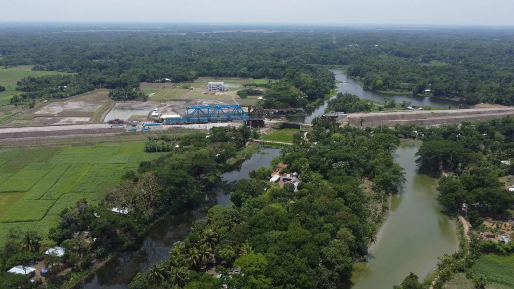
The Role of Drones in Canal Surveying
The role of drones in canal surveying is highly effective and innovative. The use of drones provides numerous advantages in creating accurate maps, analysing, and monitoring canals and other waterways. The key roles and benefits of drones in canal surveying are as follows:
1. Rapid and Accurate Data Collection
Drones can fly over canals quickly and capture various high-resolution images and videos with precision. This helps in swiftly analysing the canal’s length, width, depth, and the characteristics of the surrounding land.
2. Access to Remote and Hazardous Areas
Many canals are located in areas that are difficult or dangerous for manual surveying. Drones can easily access such places, where manual equipment or human presence may be risky, such as muddy canals or narrow waterways.
3. 3D Mapping and Model Creation
Using the images and data collected by drones, three-dimensional (3D) models of the canal can be created. These models allow detailed analysis of the canal’s depth, flow direction, bends, and the surrounding land.
4. Monitoring of Flow and Water Management
Drones can regularly monitor the flow of the canal, water levels, and the conditions of nearby flooded areas. This plays a significant role in water management and canal maintenance.
5. Monitoring Terrain and Changes
Drones can easily observe changes in the land surrounding the canal, such as landslides or riverbank erosion. If any changes occur near the canal, drones can quickly capture them, and the data can be analysed.
6. Canal Maintenance and Inspection
Drones make it easier to monitor the condition of canals and identify maintenance needs. For example, drones can help determine if a canal is blocked, if aquatic plants have overgrown, or if any damage has occurred.
7. Measuring Canal Depth and Analysing Water Flow
Drones can be used to measure water levels and flow in canals, especially using LIDAR or SONAR technology. This helps in determining the canal’s depth, soil deposition, and the exact amount of water flow.
8. Environmental Impact Analysis
The environmental condition of the canal and its surroundings can be analysed through drones. Using high-resolution images and sensors, drones can assess water quality, pollution, and the impact on aquatic plants or animals in the canal.
9. Data Analysis and Reporting
Data collected from drones can be easily analysed and reports can be generated through various software. These reports provide valuable information for canal development or maintenance.
Summary:
Drones collect data quickly, accurately, and cost-effectively in canal surveys. They make it easier to analyse the canal’s condition, perform maintenance, and monitor environmental impacts, thereby improving the overall canal management process.
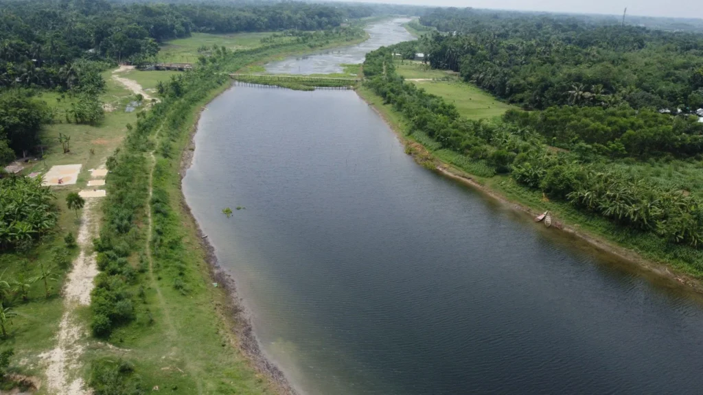
The Role of Drones in River Surveys
Drones play a highly effective and technologically advanced role in river surveys. Through the use of drones, the depth, width, flow, and surrounding geographical conditions of a river can be observed quickly and accurately. Drones are particularly useful for analysing the river’s condition, maintaining it, and determining the environmental impact. Below are some key roles of drones in river surveys:
1. Fast and Accurate Data Collection
Drones can quickly and accurately fly over rivers to capture high-resolution images and videos. This helps in analysing the river’s width, depth, flow direction, and the condition of nearby land.
2. Access to Remote Areas
Some parts of rivers are located in areas where human presence or the use of equipment can be risky. Drones can easily access such areas where manual surveys might be difficult.
3. Creation of 3D Maps and Models
Data collected by drones can be used to create three-dimensional (3D) models of rivers. These models are helpful for analysing the river’s depth, bank changes, flow direction, and bends.
4. Regular Monitoring and Flow Analysis
Drones can regularly monitor the river’s flow, water levels, and flooded areas. This is highly effective in flood prevention and water management.
5. Water and Environmental Analysis
Drones can analyse the quality of river water, pollution levels, and the condition of biodiversity connected to the river. By using sensors and cameras, monitoring the water condition becomes easier.
6. Monitoring Changes to Riverbanks
Riverbank erosion, land shifts, and changes can be easily observed through drones. This helps in taking preventive measures against future damages.
7. River Maintenance and Repair Monitoring
Drones can determine the maintenance and repair needs of rivers. If any damage is detected in a river’s dam or bank, it can be quickly identified and necessary steps can be taken.
8. Precise Measurement of River Depth and Flow
Drones equipped with LIDAR or SONAR technology can accurately measure the river’s depth, flow, and sediment deposits on the riverbed.
Conclusion:
The use of drones in river surveys is extremely effective in collecting, analysing, and identifying maintenance needs in a precise and efficient manner. This allows for better environmental impact analysis, flood management, and riverbank safety, ultimately improving the overall management of rivers.
The Role of Drone Surveys Before Starting Large-Scale Projects
Drone surveys play a highly important and effective role before initiating large-scale projects. Through drones, it is possible to collect accurate and fast data during the early stages of a project, which aids in planning, designing, and execution. Drone surveys provide essential data for complex projects, making decision-making more efficient.
Below are the roles of drone surveys before starting large-scale projects:
1. Fast and Accurate Data Collection
Drones can quickly collect accurate data over large areas in a short amount of time. They capture high-resolution images and videos, which can later be analysed using software. Accurate and updated data is crucial for large projects, and drone surveys help fulfill that need.
2. Creating Accurate Site Maps
Drone surveys can produce three-dimensional (3D) maps of the project area, which assist in analysing land, boundaries, elevation, and the surrounding geographical conditions. Based on these maps, the project’s design and work plan are developed.
3. Surveying Remote and Hazardous Areas
Large projects often involve areas that are difficult to reach. Drones can easily fly over and survey such remote areas, where manual surveying might be challenging or dangerous. The use of drones enhances site safety during the project.
4. Environmental Analysis
Drone surveys are highly effective in determining environmental impacts in the project area. Drones equipped with sensors and cameras can measure air, water, and land quality, which aids in assessing environmental risks and taking appropriate actions for the project.
5. Cost and Time Efficiency
Using drones, survey activities for large projects can be completed much faster and at lower costs. Traditional methods are time-consuming and expensive, but drones reduce both time and costs, enhancing the overall efficiency of the project.
6. Monitoring Project Progress
During the project, drones can be used to regularly monitor site progress. This helps with project management and increases the likelihood of completing tasks within deadlines. Regular progress monitoring also helps in identifying issues early, allowing for timely corrective actions.
7. Accurate Boundary and Land Measurement
Drones can precisely measure the boundaries and area of the project site, an essential step before starting any project. This helps in resolving any land-related disputes.
Conclusion:
The use of drone surveys before starting large-scale projects has a significant impact on the project’s timeline, budget, and accuracy. Drone surveys provide fast data collection, accurate mapping, environmental analysis, and help ensure a safe work environment. As a result, they enhance the success and efficiency of the project.

The Role of Drones in Road Surveys
Drone surveys provide fast, accurate, and cost-effective solutions for road construction, maintenance, and planning. They capture high-resolution images and create 3D maps for analyzing road conditions, slopes, and surrounding terrain.
Benefits:
Survey remote or hazardous areas safely
Save time and reduce costs
Monitor road construction and maintenance
Analyze environmental impact
Drones enhance efficiency, safety, and accuracy, making them essential for modern road surveys in Bangladesh.
Conclusion
Drone surveys are the modern equivalent of a professional contour map, guiding projects safely and efficiently through complex terrains. Just as a contour survey deciphers the land’s twists and slopes, drone land surveying provides precise, high-resolution data to ensure your construction, infrastructure, or land development projects are planned accurately and built on solid ground.
By leveraging drones, you gain faster data collection, 3D mapping, environmental analysis, risk assessment, and cost-effective monitoring—all essential for successful project management. For a professional and accurate drone land survey in Bangladesh, contact Sonar Bangla Survey Consultants at +880 1742 585592 to get a free quotation from a team with a proven track record of excellence, boasting over 150 5-star reviews on Google.drone land surveying

