What is a Digital Railway Survey?
A Digital Railway Survey is a modern process that uses advanced technology to gather and analyze precise data on land and surrounding areas for the construction of railways. Various digital tools like Total Stations, drones, and GPS technology are used in this survey. This enables the creation of 3D models of terrain, helping to ensure accuracy and informed decision-making during railway planning.
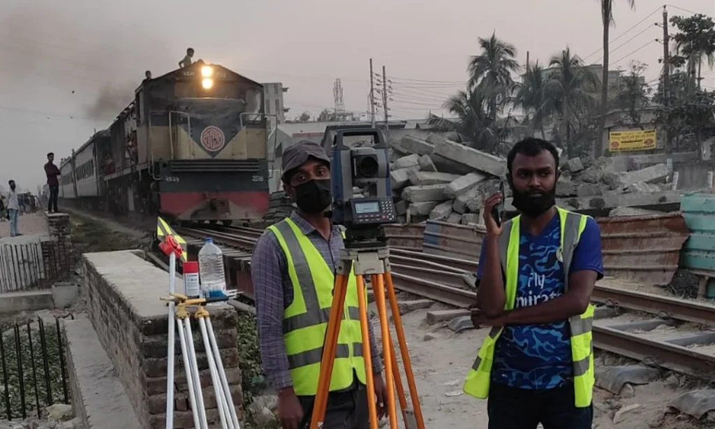
Here are some key features of a digital railway survey:
- Total Station: Used to accurately measure land angles and distances.
- Drones and 3D Modeling: Drones are deployed to survey areas and produce precise 3D maps.
- GPS Technology: Provides accurate coordinates to assist in railway line alignment.
- Digital Data Analysis: Collected data is easily analyzed and updated, enhancing the accuracy of the project.
This method allows railway projects to be completed faster, with greater precision, and in a cost-effective way, while also assessing environmental impacts and staying within financial constraints
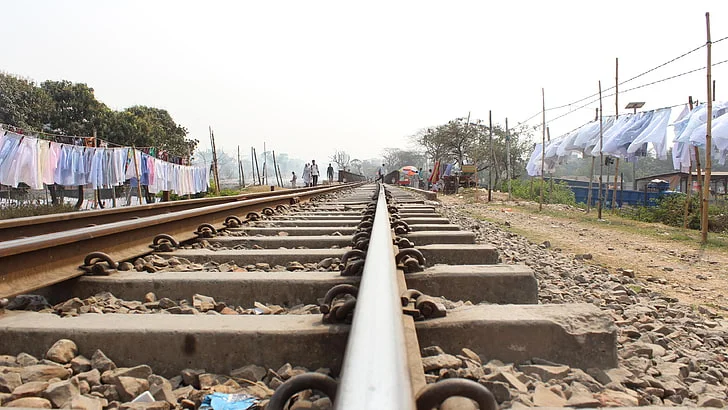
What are the stages involved in the implementation of a railway survey project?
A railway survey project involves several stages that must be carefully followed to ensure proper implementation. The key stages are as follows:
- Preliminary Planning and Survey:
Objective Definition: Determining the purpose of constructing the railway line.
- Map and Data Analysis: Studying existing maps and analyzing previous survey data.
- ·Feasibility Study: Assessing the technical and economic viability of the project.
- Site Survey:
- ·Topographic Survey: Identifying land elevation, slopes, and other geographical features.
- ·Land Ownership and Boundary Determination: Verifying the land’s ownership and setting boundaries.
- ·Environmental Survey: Analysing the environmental impact, particularly on water bodies, forests, and biodiversity in the project area.
- Design and Planning:
- Railway Design: Creating the initial layout of the railway line, including line width, stations, and other infrastructure.
- Engineering Design: Designing necessary structures such as bridges, tunnels, and flyovers.
- Signalling and Safety Systems: Planning for railway signalling systems and safety features.
- Financing and Budgeting:
- Cost Estimation: Estimating costs for each stage of the project.
- Funding Sources: Deciding between public funding or private investments for financing the project.
- Project Approval:
- Legal Approvals: Securing necessary permissions from government and local authorities.
- Community Consultation: Discussing the project with local communities to gather feedback and address concerns.
- Construction Phase:
- Preliminary Construction Work: Preparing the land, and constructing bridges and stations.
- Track Installation: Laying railway tracks and installing signalling systems.
- Station and Infrastructure Construction: Building stations, platforms, and other required facilities.
- Testing and Operational Readiness:
- Trial Run: Conducting test runs to ensure the functionality of the new railway line and stations.
- Safety Checks: Ensuring that the railway system and signalling systems are working safely.
- Operation According to Plan:
- Commencement of Rail Operations: Beginning train operations and activating the stations.
- Maintenance Plan: Establishing a plan for regular maintenance and surveys to keep the system running efficiently.
These stages play a crucial role in the successful implementation of a railway survey project.
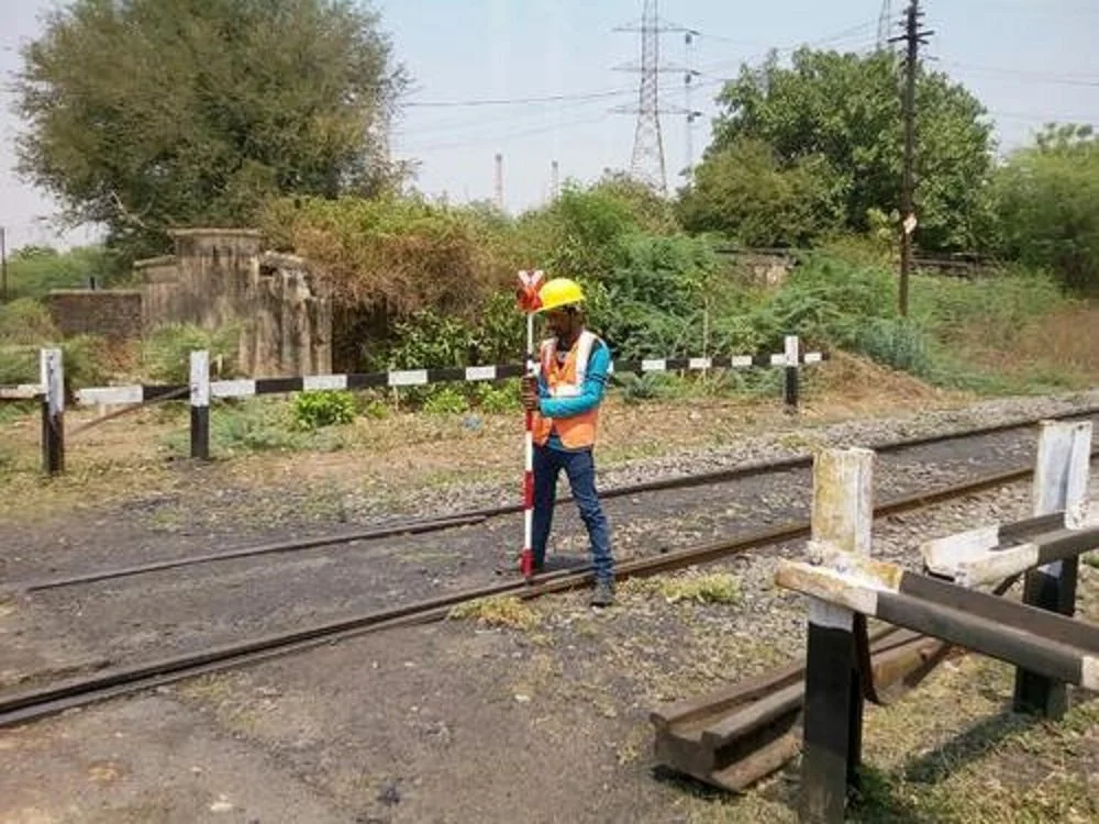
Railway Survey for Justification of Constructing New Line
However, When the question of constructing a new railway Survey line due to public demand or some other reason, demands an intensive study as regards the viability of the project.
Digital Railway Survey for a New Railway Line
A digital railway survey for a new railway line is a modern method that utilises advanced technology to effectively gather and analyse data about the land and terrain. This process employs various digital tools for the rapid and accurate collection of information. Below are the key aspects of a digital railway survey for a new railway line:
1. Use of Digital Technology
- Total Station and Drones: Digital railway surveys for new railway lines use total stations and drones. The total station measures distance and angles accurately, while drones capture aerial images and help create detailed maps of the area.
2. Accurate Data Collection
- 3D Modelling: Digital technology allows for the creation of precise 3D models of the land, essential for planning and design.
- Detailed Measurements: The survey provides accurate measurements of land elevation, slopes, and other topographical features.
3. Time Efficiency
- Rapid Data Updates: Digital surveys allow for quick updates of the collected data, facilitating faster decision-making during the project.
4. Environmental Analysis
- Environmental Impact: Digital tools help assess potential environmental impacts of the project, such as effects on wetlands, forests, and local biodiversity.
5. Legal Compliance and Safety
- Legal Requirements: Digital surveys make it easier to meet legal standards and identify any potential issues in the project area.
6. Land Survey
- Topographical Analysis: Before laying the railway, a thorough land survey is conducted to collect information about land elevation, slopes, and features that are essential for construction.
7. Environmental Impact Assessment
- Analysis of Natural Ecosystems: It is important to assess the environmental impact, which includes analysing the potential effects on natural ecosystems, water bodies, and local communities.
8. Community Engagement
- Consultation with Local Communities: Engaging with local communities helps gather important insights into their concerns and needs, contributing to the success of the project.
9. Technical Assessment
- Evaluation of Technical Specifications: The survey also evaluates technical aspects such as railway gauge, signalling systems, and other necessary requirements for the project.
10. Economic Analysis
- Cost and Benefit Analysis: The project’s financial viability is assessed by analysing potential costs and benefits during the railway survey.
Conclusion
The railway survey for a new railway line is a critical process that involves collecting and analysing various types of information. A digital railway survey is faster, more accurate, and more effective than traditional methods. It plays a key role in ensuring the success of the project by analysing technical, environmental, and economic factors.
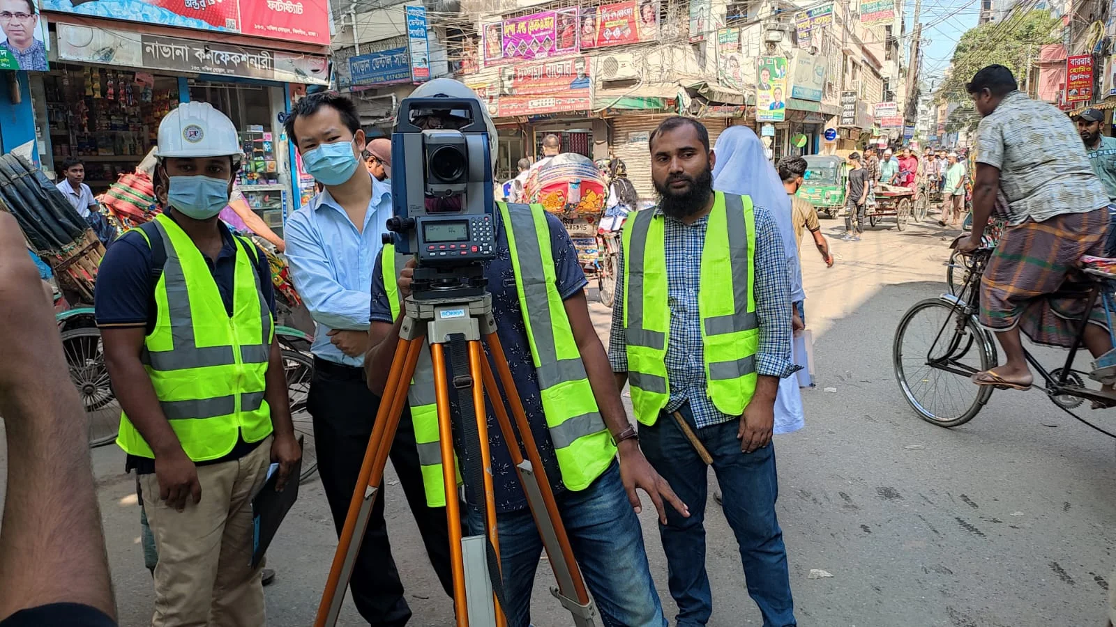
Railway Survey for New Railway Line
To construct anything haphazardly is not engineering. Likewise, Sonar Bangla Survey Consultants Prior to the survey, we ensure a thorough study of the available maps of the proposed area.
Similarly, this helps in fixing suitable alignment facilitate various surveys work. Moreover, the previous engineering surveys we follow first so that can broadly help for a new railway Survey line.
Use of RTK GPS in Railway Surveying
RTK GPS (Real-Time Kinematic GPS) technology plays a crucial role in railway surveying by providing the following advantages:
- Accuracy: RTK GPS offers centimetre-level accuracy, essential for railway line construction. It is particularly used in land surveys where precise data is vital.
- Speed: This technology accelerates the surveying process by providing real-time data, helping to reduce project timelines and costs.
- Safety: RTK GPS delivers accurate location information, ensuring safety for railway projects. Using precise coordinates enhances the safety of construction activities.
- Rapid Data Collection: RTK GPS enables fast and real-time data collection, saving both time and costs during surveys. This aids in meeting project deadlines.
- Legal Assurance: RTK GPS helps accurately determine land boundaries, which is important for legal documentation concerning land ownership and boundary issues.
- Environmental Analysis: RTK GPS is effective for assessing the environmental impact of railway construction. It aids in accurately mapping land use and natural features, such as water bodies, forests, and local biodiversity.
- Technological Integration: RTK GPS can easily integrate with other technologies, such as total stations and drones, facilitating the utilisation of various technological advantages.
- Support for Infrastructure Planning: The use of RTK GPS in railway projects is critical for designing various infrastructures like bridges, tunnels, and stations, providing necessary accurate data for planning and design.
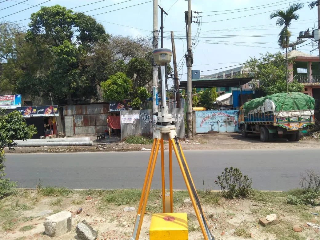
Impact of RTK GPS on Railway Projects
RTK GPS is an indispensable technology for ensuring the efficiency and success of railway projects. By leveraging modern technology, it enhances project accuracy and safety, which is essential for advanced railway transportation systems.
Static Survey in Railway Projects
A static survey in railway projects is an important process used to determine specific positions and characteristics of the land. This survey collects accurate information for project planning and implementation. Below are the key aspects of static surveys in railway projects:
1. Objectives of Static Surveys
- Position Determination: Identifying the exact locations of railway lines, stations, and other infrastructure.
- Land Characteristics: Determining the elevation, slope, and other geological features of the land.
- Design Development: Collecting necessary information for the design and planning of the project.
2. Survey Process
- Equipment Selection: Selecting high-precision GNSS receivers, stations, and surveying equipment.
- Station Setup: Establishing a stationary base for the survey.
- Data Collection: Collecting data over a specific period by placing receivers at various locations. Generally, data is collected at a point for 10 to 30 minutes.
- Data Analysis: Analysing the collected data to determine the exact position and elevation.
3. Benefits
- High Accuracy: Static surveys provide centimetre-level accuracy.
- Long-lasting Data: Collecting data at the same location for an extended period enhances data accuracy.
- Various Applications: It can be used for design, construction, and maintenance.
4. Challenges
- Time-Consuming: Static surveys are relatively time-consuming as data must be collected for a long duration at a single point.
- Weather Impact: Poor weather can create issues during the survey process.
5. Technical Details
- GNSS Technology: GNSS receivers are used to ensure accurate positioning. Data is exchanged between the base station and remote receivers.
- Data Processing: Collected data is processed using software to create the final report.
6. Practical Steps
- Planning and Preparation: Proper planning and preparation are essential for the survey.
- Team Readiness: The survey team must be trained to ensure they are proficient in using technology and equipment.
- Disaster Management: Prepare to handle any disruptions that may occur during the survey.
7. Implementation
- Field Testing: Verify the effectiveness of the survey through field tests as per project requirements.
- Monitoring: Ensure accuracy through regular monitoring during construction and maintenance.
Static surveys are an essential component of accurate planning and implementation in railway projects, providing high precision and long-lasting data.

Use of RTK GNSS in Railway Projects
The use of RTK GNSS (Global Navigation Satellite System) technology in railway projects is becoming increasingly popular, especially in design, construction, and maintenance. Here are the various aspects of using RTK GNSS and GPS:
1. Basic Concepts of RTK GNSS and GPS
- RTK GNSS: This is a GPS technology that utilises a centralised base station and remote receivers. It provides real-time position information and achieves centimetre-level accuracy.
- GPS: This is a specific satellite system known as the Global Positioning System. GPS typically offers metre-level accuracy, which is less precise than RTK.
2. Applications in Railway Projects
- Railway Line Design: RTK GNSS assists in determining the exact positions and dimensions during the design of railway lines.
- Construction Phase: RTK is used to identify the precise locations of the land during construction, which is crucial for infrastructure development.
- Maintenance: In the maintenance of railway lines and stations, RTK GNSS data is used to identify and address issues.
3. Benefits
- High Accuracy: RTK GNSS provides centimetre-level accuracy, which is essential for railway projects.
- Rapid Data Collection: Data can be collected from multiple points in a short period.
- Real-Time Data: The use of real-time data allows for immediate decision-making.
4. Challenges
- Signal Weakness: Signals may weaken due to trees, buildings, or other obstructions, affecting data accuracy.
- Technical Expertise: The use of RTK GNSS may require technical expertise.
5. Practical Steps
- Equipment and Software: Select modern GNSS receivers and software that support RTK.
- Training: Train the team on the proper use of RTK GNSS technology.
- Data Analysis: Ensure the decision-making process is supported by analysing the collected data.
6. Implementation
- Field Testing: Verify the effectiveness of RTK GNSS use through field tests as per project requirements.
- Regular Monitoring: Ensure accuracy through regular monitoring during construction and maintenance.
The use of RTK GNSS technology in railway projects can help ensure the success and timeliness of the project.

Reconnaissance for Railway Survey
Along with the Provisional Configuration. We conduct the survey to collect the following data:
- The Preliminary Orientation of the lines of the Configuration. Likewise, we measure by Direction compass. Furthermore, And the distances we measure by pacing (i.e. Walking) and note down in a field book.
- Approximate positions of different objects and the nature of the ground. Therefore, we can Compute the strip of land covering above 100 m on both sides of the Adjustment.
- We conduct a soil survey subsequently with the Coordination of sides.
- Boring should be done along the Positioning to know the nature of the water table.
- By the Abney level or hand level, we determine the slope or Oscillation of the ground.
- However, we note down the number of crossing points, like roads, rivers, canals, etc. Similarly, we also record Elaborate information regarding these points so that it is possible to design Proper structures to cross them.
- Specifically, consciously we note down the number of curves and Challenges most Significantly for curve setting.
Some Other Reconnaissance of this Survey
- Moreover, with detailed information, we note down the number and position of culverts or bridges. Therefore, they can help us pertaining to span, HFL, discharge, etc.
- SBSC Team also collects the rainfall records of that area and the discharge records (for the past 10 years) of big rivers.
- Likewise, Large depressions and high summits we try to avoid as far as possible so that we can minimise the cost of earthwork or tunnelling. Specifically, where they are unavoidable, we keep a record of detailed information regarding these obstacles.
- Likewise Finding the availability of construction material and the possible route for their collection. As a result, we can minimise the construction cost and save time.
- But also, we collect data on the availability of labour, suitable places for labour colonies, etc.
- We prepare a project report accompanied by an index map of alignment, approximate longitudinal section, the number of curves, culverts, bridges, etc. But also, to select a suitable alignment for a preliminary survey.
- SBSC Team prepares a preliminary record of properties for which compensation is to be paid along with such details as the name of the owner, quantity of land, present valuation, etc.
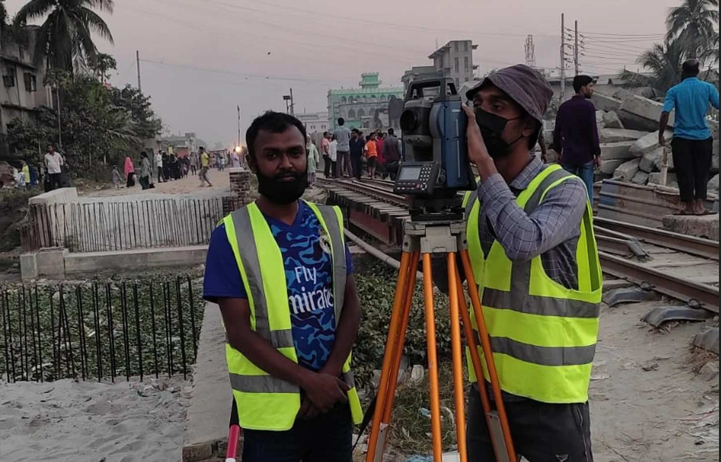
Importance of Reconnaissance for Railway Survey
Therefore, by reconnaissance survey, we can find out a number of possible alternative routes between two points. Similarly, this information becomes very useful at the stage in the selection of the best possible route between two points.
Additionally, the successful conduct of the reconnaissance survey entirely depends on the personal qualities and abilities of surveyors. Specifically, they should have proper training and experience, the capacity of observation and interpretation of the territory, etc.
Instruments We Use in Reconnaissance for Railway Survey:
- Aneroid Barometer
- Prismatic Compass
- Binocular telescope
- Pedometer
Preliminary Railway Survey
The objects of the preliminary survey are
- To conduct the survey work along the alternative routes (found out by reconnaissance survey) with the help of theodolite and levelling instruments.
- Determining the greater accuracy of the cost of the railway line along these alternative routes involving
- Cost of removing the obstruction, construction of bridges, etc.
- To decide the most economical and efficient route.
Importance of Preliminary Survey
Moreover, the preliminary surveys decide the final route and recommend only one particular route in preference to other alternative routes. Thus, we conduct the preliminary survey with greater precision as the alignment of the final route depends on it.

Works of Preliminary Railway Survey
We mark out the x-sections of all representative points along the route and features. We take the cross-sections at 500 ft intervals normally.
Similarly, where the route crosses a river, we survey the river in detail for about one mile on either the upstream and downstream sides. Furthermore, we prepare the detailed maps and calculate the cost of different alternatives accurately to select the most economic routes.
The following points we should keep in mind while considering the justification of Constructing a new line
- The total population of the villages, towns, industrial places, etc. coming –under the project.
- Thorough studies of the standard of living and habits of the population, and the economic conditions of the locality. Moreover, after all they will be a source of revenue for the department.
- The amount of agricultural, natural, and industrial resources.
- Information regarding religious places, religious fairs of festivals, business centres, etc.
- Estimation of the amount of revenue that may accrue from passengers, agricultural goods, industrial goods, natural resources, etc.
- Studies of the topographical maps to determine the number of culverts, bridges, level crossings, tunnels, etc.
- Also, we need to study an agricultural map so that we can avoid the affection of too much valuable land.
- We study a contour map in order to ensure economical alignment, avoiding unnecessary cutting or filling, and maintaining a permissible gradient.
- Moreover, we study an Industrial map to find the shortest route to connect industrial areas.
Reconnaissance for Railway Survey and Information Gathered
We generally gather information in the following two categories:
(01) Traffic Reconnaissance Survey.
(02) Engineering Reconnaissance Survey.
Traffic Reconnaissance Survey
This consists of a collection of information regarding the following:
1. General character of the country and the extent of cultivation.
2. Local industries and religious festivals.
3. Likewise, The general conditions such as the prosperity of people in the locality and the density of population and its distribution.
4. The probable amount of traffic to be served by a new railway line.
5. The probable new traffic lanes to be opened up to join large trade centres
6. Nature and volume of exports and their destination and origin.
7. The number of imports and centres of their distribution.
8. Possibilities of development of new industries and irrigation schemes as a result of new railway lines.
Marking of Tentative Alignment
After the decision to set up a new railway line, We mark the tentative alignments on the contour map and topographical map for the area
While marking the tentative alignment, the following points should keep in mind:
- The route should be as short as possible.
- As far as possible, it should follow the ridgeline to avoid unnecessary earthwork in filling.
- It should cross rivers perpendicularly.
- Should not pass through religious places, such as temples, mosques, churches, etc. or burial grounds, burning Ghats, and so on.
- The route should not pass through the centres of villages, towns, valuable structures, etc. where the compensation payable is quite higher.
- It should not be too zigzag so that the number of curves is minimised.
- It should not cross large depressions or valleys, high summits, or ridgelines, to avoid huge earth fillings in areas of depression and tunnelling in regions including summits.
- The tentative alignments of the two routes should be marked to compare the costs of construction, feasibility, advantages, etc.
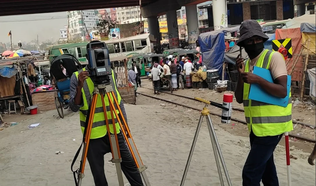
Location Survey
Location Survey is the final survey to locate the centerline of the railway line. But also, the main object of this survey is to carry out a detailed 3d survey along the route. Moreover, which represents the most economical route from the data of the preliminary survey.
Importance of Location Survey
Additionally, the location survey establishes the centerline of the actual track to be laid. But also, hence after completion of the location survey, the construction work starts.
Final Location Survey
Likewise On the basis of the preliminary survey, we select the most economical route. Before the approval of the project, we complete the final location survey in all respects. Similarly, this survey helps the engineers in charge of construction projects.

