What is a Route Survey?
A route survey refers to the surveying activities conducted over a narrow strip or corridor to identify and construct any transportation or communication system-related lines.
Effectiveness of Route Surveys
A route survey encompasses all survey activities necessary for the design and construction of engineering works such as highways, pipelines, canals, or railways. In Caltrans, a route survey system is typically associated with highway design and construction.
If you’ve ever wondered how new roads, railways, pipelines, or even power lines find their way through landscapes, one of the most important steps is the route survey. Often overlooked but crucial, route surveys are essential for understanding the key elements of an effective and efficient route survey.
At its core, a route survey is a specialized type of land survey that focuses on determining the optimal path for new transportation or utility routes. It’s not just about finding the shortest distance between two points; it involves a meticulous process of data collection, terrain analysis, understanding environmental impacts, and considering legal aspects. Route surveys form the backbone of infrastructure development. Surveyors examine property boundaries, existing utilities, and land use regulations. Route surveying is comprised of all the survey activities necessary for the design and construction of engineering works like highways, pipelines, canals, or railways.

Preliminary Survey
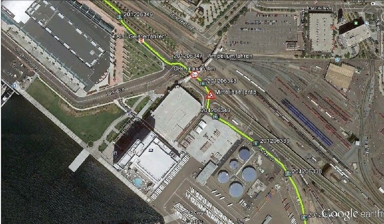
The preliminary survey is essentially a detailed mechanical examination or survey conducted along one or more routes established during the inspection survey, over a narrow survey area. Its primary objective is to prepare an accurate and precise geological map of the narrow survey area along the routes determined in the inspection survey and to estimate the potential costs for the construction of such planned lines.
Therefore, a continuous line, similar to a traverse, is established along the selected route, and various distance, elevation, and angular measurements are taken with accuracy, so that the topography of the survey area covered by the route’s alignment can be accurately mapped. The width or extent of such a strip or belt must be sufficient so that even if the path of the route line is slightly altered in the final stages, it remains within the boundaries of the strip or belt.

Project Surveying:
Project surveying encompasses all field activities related to the planning and construction of engineering projects such as railways, roads, highways, irrigation canals, sewage lines, tunnels, dams, etc. It includes the necessary calculations, along with maps, profiles, and other relevant drawings. Projects must be planned in such a way that they can be constructed at the lowest cost and be suitable for optimal use.
Route Survey: The Initial Step for Any Infrastructure Project
A route survey is a crucial process that serves as a foundational step for the proper planning and implementation of any infrastructure project. Typically, it is used for long-distance infrastructure projects such as roads, railways, pipelines, bridges, and others. The route survey helps to identify the project’s path and potential obstacles, making it easier to select the appropriate site and design the project accurately.
Key Objectives of a Route Survey:
- Path Definition:
The route survey helps in determining the potential route where the infrastructure will be constructed. It’s essential to specify were roads, railways, or pipelines will be placed. - Assessment of Terrain and Obstacles:
Any natural or man-made obstacles along the route—such as mountains, rivers, valleys, buildings, or forests—are identified. Solutions for overcoming these obstacles are then planned. - Determination of Length and Width:
The survey plans the specific length and width required for the road or other infrastructure, providing precise information about measurements and space. - Soil Quality and Stability Analysis:
It is vital to determine how stable the soil is and if it is suitable for construction. Soil tests assess its load-bearing capacity and quality. - Estimation of Costs and Scheduling:
A route survey forecasts potential costs and schedules, which are critical for project management.
The Route Survey Process:
- Preliminary Survey:
Initial data is collected regarding the local terrain and environment. - Field Survey:
A direct survey is conducted at the site using tools like GPS, theodolites, and leveling instruments. - Mapping and Data Analysis:
A detailed map of the route is created, and all the data is analyzed. This helps designers and engineers develop the correct design for the route. - Report Preparation:
All the collected data, measurements, and proposed plans are compiled into a comprehensive report, aiding in final decision-making for the project.
Importance of Route Survey:
- Helps in determining the correct route.
- Reduces risks associated with construction.
- Provides cost and time forecasts.
- Ensures stability and functionality.
Without a route survey, managing a long-distance infrastructure project is challenging, as it provides a clear understanding of potential obstacles and the optimal use of resources.
Preliminary Survey:
This survey is conducted very quickly and is of a draft nature. However, it involves a detailed examination or testing of multiple potential routes across the entire area between the selected endpoints, with the objective of selecting the best route and estimating the costs associated with the planned line.
Thus, it is essential to determine the path of all potential routes existing between the endpoints, considering which route is the most advantageous and requires further detailed and accurate examination in subsequent surveys. Among the sequential steps in route selection, the preliminary survey is the most important and is regarded as the foundation or key of the project. Therefore, thorough examination must be conducted across the entire survey area to ensure that no potential route is overlooked or excluded from consideration. This survey is not restricted to only one specific or easier route.
The preliminary survey is not, in essence, a primary survey. If there is an error in route selection, it can lead to significant losses for the entire project unless it is immediately identified and corrected before the construction work begins. Consequently, such errors can persist for years, leading to difficulties in competitive contexts, particularly in the case of railways. Thus, the responsibility of conducting the preliminary survey should be entrusted to an experienced engineer who is a subject matter expert, impartial, diligent, and proficient in engineering business judgment, along with being visionary and having a natural inclination toward the work.
Initially, the survey engineer must ensure the availability of the best designs for the area under investigation (e.g., the Survey of Bangladesh, Land Records and Survey Department of Bangladesh). This is because a careful review of these designs is very helpful for illustrating various potential routes. With such designs in hand, the survey area should be traversed on foot, horseback, or in a motor vehicle to gather comprehensive and accurate information regarding the suitability and characteristics of each potential route, requiring detailed examination. However, in the case of difficult and hazardous routes, it is necessary to traverse from both ends along the route.
This is because a route might not be considered suitable when traveled from one end but could be very suitable when approached from the other end. During this survey, instruments such as aneroid barometers, clinometers, pedometers, and abrometers are used for quickly measuring height, distance, and slope. Meanwhile, a compass is used for changing direction. The notes taken in the field are generally listed on the obtained designs and recorded in descriptive form in a notebook. However, if the designs are unavailable, the information gathered through the survey is used to prepare a draft geomorphological map of the surveyed area.

During the preliminary survey, information must be collected on the following aspects:
- The geomorphology of the relevant region or area.
- Potential ruling gradients.
- Important locations such as any towns, markets, or hats in the interior, production centers, saddles, river crossing points, underground tunnels, and restricted areas, etc.
- Geographical factors affecting the stability of the route and the foundation of bridges.
- The extent of the waterways of crossed rivers or canals.
- The maximum flood boundary line.
- Availability of necessary materials and labor for construction.
- Special structures.
- The number and length of important bridges.
- Land values.
- In the case of railways, the potential number of curves, minimum radius, and suitable locations for stations.
- The total length of the route.
The following items are desirable to be included in the inspection report:
- A summary of the collected data.
- Descriptions of various alternative routes and recommendations regarding one or more routes.
- An estimate of the construction costs.
- An analysis of financial viability.
- Inclusion of designs and photographs.
As a result of the inspection survey, one or two routes are selected as the most suitable for detailed analysis in subsequent stages. Currently, high-quality geomorphological maps are prepared using special cameras under “aerial photographs,” and such maps are extremely valuable in areas where thorough examination is not possible and local designs are not available for route selection.

Quality of Our Route Survey Services
We place great importance on the quality of our route survey services. Our goal is to provide the highest standard of service, ensuring client satisfaction and the successful implementation of projects. To maintain the quality of our services, we adhere to the following principles:
1. Use of Advanced Technology:
We employ the latest technology and equipment, such as GPS, theodolites, leveling instruments, etc., which assist in collecting accurate and precise data.
2. Experienced Team:
Our team consists of skilled and experienced engineers, surveyors, and specialists who are specifically trained in conducting route surveys. They ensure high-quality service through their expertise and experience.
3. Quality Control:
Quality control is implemented at every stage of our services. We conduct regular reviews and analyses to ensure timely and accurate data delivery.
4. Customized Solutions:
We provide customized route survey solutions based on our clients’ needs, making them suitable for the specific requirements of each project.
5. Fast and Efficient Service:
Our services are prompt and efficient. We deliver reports on time to align with the project schedule.
6. Comprehensive Reporting:
At the end of the survey, we provide a detailed and comprehensive report, which aids clients in effective planning and decision-making.
We believe that our high-quality route survey services ensure the success of projects for our clients and enhance their satisfaction with our services.
Report Overview
- Route Survey Control
- Line or Lines
- Apparent Boundaries, Right of Way, and Profession Lines
- Current Documentation of Records
- Section Lines
- Surveyor’s Report
Advantages of a Route Survey
There are many advantages of conducting a route survey, which plays a critical role in the successful planning and implementation of infrastructure projects. Here are some key benefits:
- Accurate Planning: A route survey allows for the creation of precise and effective plans, essential for the project’s success.
- Predictability: By gaining insights into potential obstacles and natural conditions, it’s possible to forecast the costs and timeline for the project.
- Risk Reduction: It helps identify potential risks along the project route, aiding in problem-solving during construction.
- Subsurface Infrastructure Identification: It allows for the identification of underground pipelines, cables, and other infrastructure, supporting smoother construction.
- Soil Quality Analysis: By assessing land quality and stability, it ensures the suitability of the land for construction.
- Environmental Assessment: It helps determine the environmental impact of the project, ensuring compliance with ecological standards.
- Design Improvement: A route survey contributes to creating a proper design for the project, enhancing future maintenance and operational efficiency.
- Documentation: Accurate documentation can be created through the route survey, which is useful for future review and analysis.
These advantages make route surveys crucial, especially when planning large and complex infrastructure projects.

In the final stage, the work may involve the following:
- Furthermore, the centerline is identified and is typically marked with stakes at necessary intervals known as stations.
- Determining the elevation along and across the centerline for plotting profiles and cross-sections.
- Similarly, plotting profiles and cross-sections and fixing the grade.
- Calculating the volume of earthwork and preparing a mass diagram.
- Outlining the alignments for cutting and filling.
- Likewise, identifying drainage areas that will be used in the design of ditches and culverts.
- Similarly, constructing structures such as bridges and culverts.
- Identifying the right-of-way boundaries for the route survey, as well as, if necessary, marking the fence line.
Purpose of a Route Survey
- Roads, highways, and railways.
- Additionally, transmission lines for communication, energy, chemicals, water, and electrical requirements.
- Canals, drainage systems, and sewers.
- Furthermore, it includes surveying for privileges like airspace, approach routes, and access rights.
- Similarly, it is conducted on a larger scale under various survey conditions (aimed at distinguishing specific subjects). Moreover, surveys are carried out in environments like sea ice conditions, river flood boundaries, and forest fire areas. Air route surveys for specific purposes, such as recording centers, are also conducted.
- Specifically, the preliminary survey for this work takes the form of topographical mapping. Likewise, surface-level mapping has been widely used for centuries to map remote areas.
This corrected version emphasizes the systematic approach and the key areas where route surveys are crucial for infrastructure planning.
Purpose of Route Survey:
Route Survey is a fundamental process for any infrastructure project, with the main objectives being:
1. Path Definition: Determining the potential route for the project, which will be used for the construction of roads, railways, pipelines, or other infrastructure.
2. Identifying Subsurface Obstacles: Identifying any natural or man-made obstacles along the route, such as rivers, mountains, valleys, or buildings.
3. Geological and Environmental Analysis: Analyzing the land’s formation, soil quality, and environmental impact, which helps ensure the project’s functionality and stability.
4. Measurements and Design: Defining the correct length, width, and height for the road or infrastructure to create an effective design.
5. Determining Construction Costs and Timeline: Providing estimates of potential costs and construction timelines, which are crucial for project management.
6. Collecting Accurate Data: Gathering precise and accurate information necessary for the project, which will be used during the design and planning phases.
7. Project Safety and Risk Analysis: Analyzing the risks and safety of the construction to provide effective solutions.
A route survey is an essential step in the successful implementation and planning of a project, which aids in the future construction process.