Surveying and LEVELING
What is Surveying and Leveling
Likewise, The process or technique by which the relative height or depth of various points or objects on the surface of the earth is determined is called Surveying and leveling.

Purposes of Surveying and Leveling
(A) Implementing various route projects like road, railway, irrigation canal, water or sewer line to determine their surface alignment and horizontal surface profile or friendliness.
(B) To determine the amount of soil to be filled or filled in different projects.
(C) Drainage area determination in Nimmo during the drainage project and to design the convenient sewer size .
(D) For topographic evaluation of the proposed reserved area for construction.
(E) Volume calculation of any reservoir, Watershed area from the contour map.
(F) To install additional B, M, in the Nimmo.
(G) For inspection of the prepared surface of roads, railways, etc.
(H) To Surveying and leveling the land of a certain area to a certain height.
(I) Slope determination of roads, railways, canals, roofs, floors, etc.
(J) To construct maximum flood plain during the construction of bridges, culverts, roads, railways, buildings.
(K) For Monitoring the leveling of the foundation floor during ecological installation.

What equipment's we use to handle the Surveying leveling work
Similarly, order to determine the elevation of different points, four things we mainly use in the leveling work which are-
(A) Surveying and Leveling machine
(B) Staff
(C) Chain or tape and
(D) One level field book or transcript
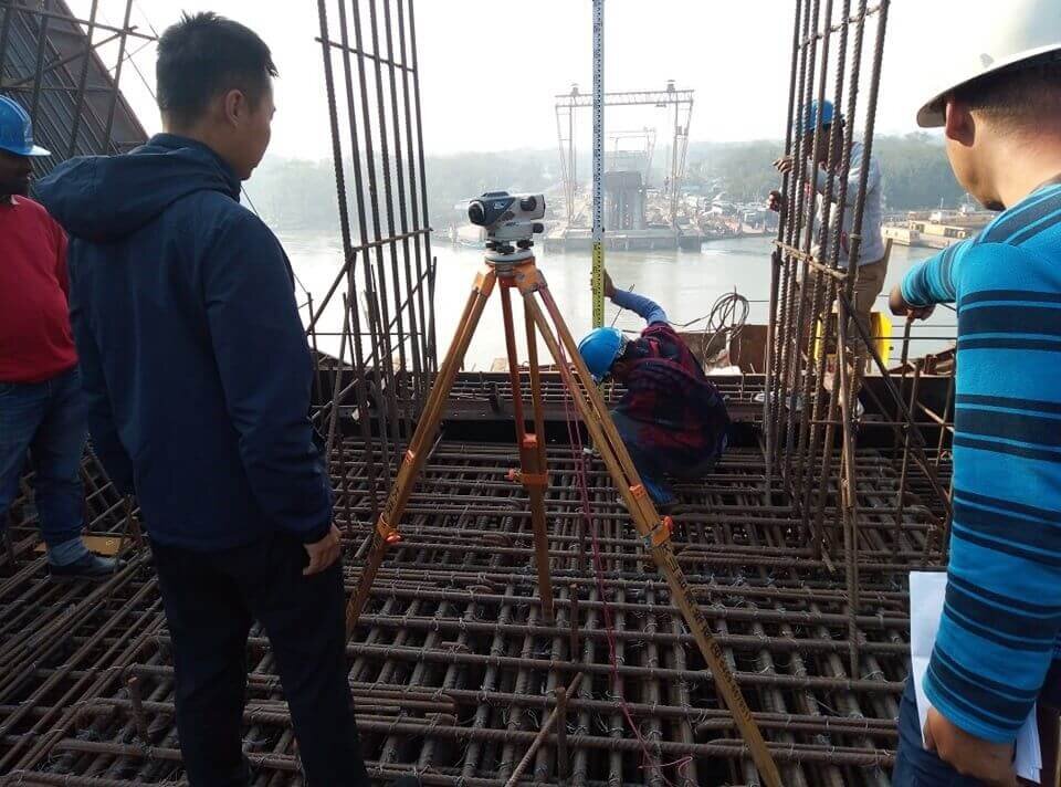
However, With the help of a level machine, we obtain horizontal vision at any point on the earth’s surface. Likewise, the horizontal line of sight, the staff measure the vertical distance of a point and chains or ribbons are used to measure the distance of different points. Additionally, We record the distance of the staff lesson and all other details of the field in the field book.
Importance of Surveying and LEVELING in Fieldwork
- Similarly, Evenizing work helps the Topographer to make a counter map of the land surface or sea surface.
- It helps the Topographer to lay a ground level on which they can build a building.
- Leveling survey data helps pipe transport engineers to clarify the appropriate slope of land that will allow smooth movement of liquid.
Differential Surveying and Leveling
Furthermore, Differential Surveying leveling is the process of measuring vertical distances from a known elevation point to determine elevations of unknown points.
The most common methods to determine elevations are
1) A compensator type, automatic (engineering level) and level rod(s),
2) An electronic digital barcode leveling instrument with a barcode rod.
Similarly, Thorough knowledge of leveling principles and proper application of methods and equipment will prevent costly delays and generate the needed results and accuracy.
Preferred methods of obtaining elevations (in order of preference/accuracy) are
- Differential Surveying and Leveling – control benchmarks, cross-sections, point elevations
- Trigonometric Leveling – for Digital Terrain Model (DTM), 3D Model
- Indirect leveling (and location) by measuring horizontal distances and vertical angles
- Three-dimensional coordinates – both horizontal position and elevation are computed by processing the measurements
- GPS survey – given the appropriate equipment, procedure, and data collection.
Moreover, Other forms of surveying and leveling are available but we are not discussing them in this manual as their use may be limited.

Similarly, The method in Figure 4-3 uses the difference in Altitude between a known Ascent and the height of the Apparatus. Therefore, the difference in Altitude from the height of the Apparatus to an unknown Ascent point.
Likewise, With a Exhaustive understanding, we provide Leveling Service to our clients. Specifically, Due to our Team’s knowledge and Proficiency we are able to meet the needs of our clients. Similarly We have adroit employees, who offer these services in agreement with the defined Instructions.
Service Description
Additionally, Sonar Bangla Survey Consultant is instrumental and well prepared in offering an excellent quality range of Surveying and Leveling.
Object-
But also, The aim of Balancing is to determine the relative heights of different objects on or below the surface of the earth and to determine the Oscillation of the ground surface.

Land Surveying and Leveling Service
Moreover, With our vast experience & knowledge in this field. But also, we are offering the best quality array of Land Surveying and Leveling to our prestigious clients. Furthermore, We are highly regarded in the industry for adhering to the latest technological standards while carrying out our services. Specifically, All aspects of the underlying situation we expect careful consideration before arriving at the Final Report.
