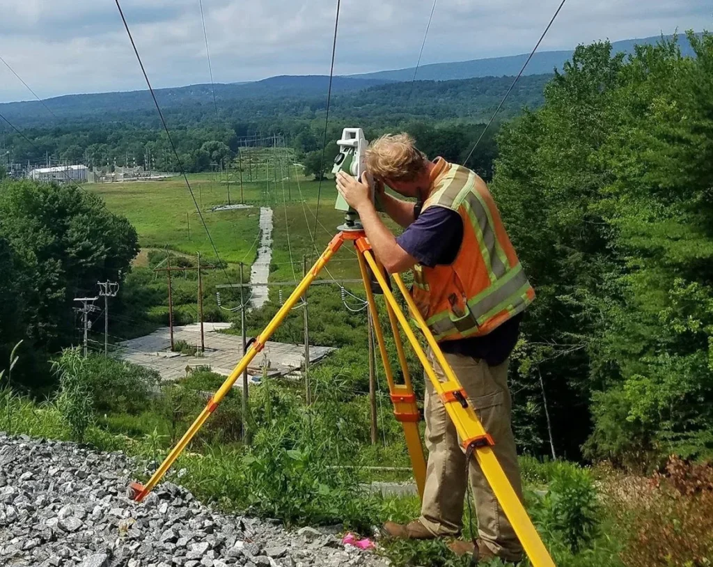
Get Latest Technology BD Transmission Line Survey
However, Riding on high Aptitudes of Fabrication ability and understanding, we are Supplying top class Transmission Line Survey. Moreover, we deliver these services in Conformity with our clients’ Prerequisites to ensure client Contentment.
In fact, in addition, we Begin these services only after Recognizing the given details of our client.
Geodetic Survey and Transmission Line Survey
Similarly, Various end uses, such as route Arrangements, laying Conveyance lines, Leading surveys, and 2D/3D seismic Investigation, require Topography surveys.
Likewise, Some of the Topography survey services offered by the Company are:
Geodetic Survey and Transmission Line Survey
Both geodetic surveys and transmission line surveys are crucial for collecting terrestrial and geospatial data, although their objectives and methods differ somewhat.
Geodetic Survey
A geodetic survey is a process used to determine the shape, size, and coordinates of the Earth. This type of survey typically utilises satellite technology and other high-tech instruments, providing accurate terrestrial data. Geodetic surveys are generally employed for various purposes, such as:
- Civil Engineering Projects: Guiding precise locations for construction projects.
- Natural Disasters: Creating local and international maps for earthquakes.
- Geopolitical Research: Analysing border delineation and land ownership.
Transmission Line Survey
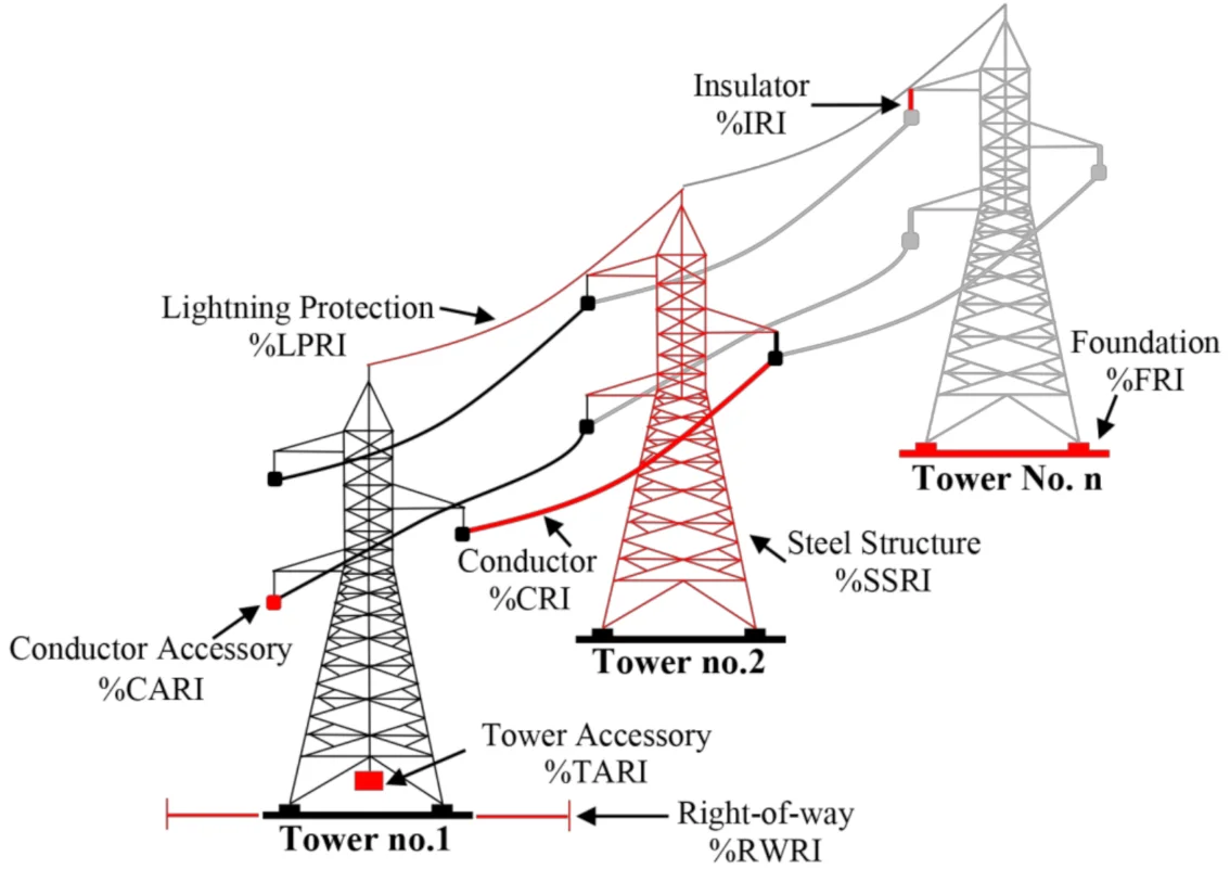
The transmission line survey is primarily utilised to determine the exact location of electrical lines for power supply. This survey is typically conducted by electric companies with the following objectives:
- Determining the Correct Route: Based on geological and environmental conditions.
- Improving Electrical Infrastructure: Enhancing the capacity of power supply and increasing the efficiency of the lines.
- Data Collection: Information gathered from the survey is used for various project planning purposes, such as the construction of new transmission lines.
Survey Process
- Geodetic Survey: Typically employs astronomy, geodesy, and modern technologies like GNSS (Global Navigation Satellite Systems).
- Transmission Line Survey: Involves collecting geospatial data using instruments like theodolites, GPS, and drone technology.
Conclusion
Both geodetic surveys and transmission line surveys rely on geospatial information, but their purposes and methodologies vary. They are essential for engineering, planning, and environmental research.

Route Alignment Survey
Additionally, Geodetic Transmission line survey Embrace the Inspection of potential Conveyance and communication routes, Integrating Conveyance line surveys, Conduits, and tunnels.
Similarly, Surveyors explore at least three alternative route Arrangements, ultimately Selecting the most optimal one.
Transmission Line Route Survey
The transmission line route survey is the process of accurately determining the location for effective electricity supply. The primary objective of this survey is to identify the most suitable and safe route for the power line, ensuring that there are no obstacles to electricity distribution. This survey is a critical step that serves as the foundation for planning and executing the installation of electrical lines.
Through the route survey, geographical and environmental information is collected, including land slope, soil conditions, water bodies, vegetation, and the location of human settlements. This process not only establishes an efficient power supply system but also allows for proactive measures to mitigate environmental and social impacts.
Importance of Route Survey:
1. Underground and Aboveground Environment: The route survey analyzes the local underground and aboveground environments, ensuring that the construction of the line does not harm local natural resources or the livelihoods of the public.
2.Climate and Weather: During the survey, climatic conditions, such as storms or other weather changes, are taken into account. This information helps ensure the safety of the power line installation.
3.Legal and Regulatory Compliance: The route survey ensures compliance with local and national laws and regulations related to land rights and environmental guidelines. Issues regarding local populations and land ownership are legally defined to prevent social or legal complications during power supply.
4.Technical Evaluation: Information obtained through the survey aids in enhancing the technical aspects of the power supply system, including line design, construction, and maintenance.
5. Land Assessment: The nature of the land, such as the presence of hills, rivers, or forests, is surveyed to determine the correct location for the transmission line.
6. Determining the Right Route: The route survey identifies the most suitable path for the installation of the power line, based primarily on geophysical conditions.
7. Environmental Impact Analysis: The survey helps identify potential impacts on the environment, making it a vital aspect of minimising environmental harm.
8. Technical Analysis: This survey identifies various technical factors, such as the location of line support systems, appropriate heights, and other structural components.
9.Social Impact: Identifying populated areas during the installation of the transmission line and minimising potential impacts on them is also a primary objective.
Survey Process:
- Local Survey: Information about the local geography, population, and environment is collected.
- Cultural and Economic Analysis: The impacts of local culture and economy are considered to facilitate the development of electricity supply in the region.
- Data Collection: Accurate information is collected through the use of modern technologies, such as GPS and drones.
Conclusion
The route survey for transmission lines plays an essential role in improving the electricity distribution system. It ensures safe and effective power supply from engineering, environmental, and social perspectives. By analysing local conditions and infrastructural situations, the survey seeks a stable and effective solution for the installation of power lines. Therefore, it should be conducted with utmost attention and careful planning
Digital Topographic Survey for Transmission Lines
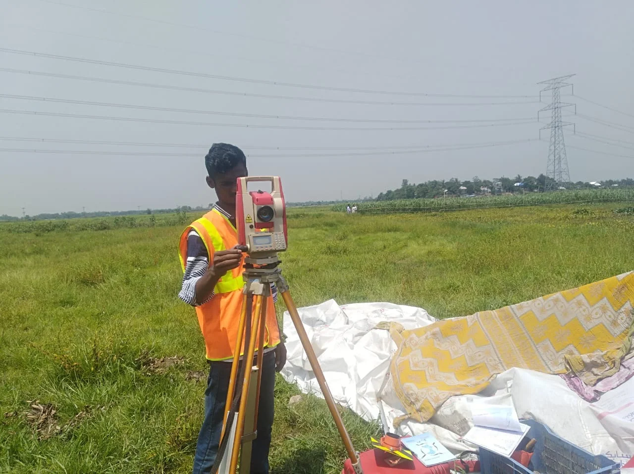
A digital topographic survey for transmission lines is a critical process that utilises advanced technology to accurately collect and analyse geographical data. Here are some key aspects of this process:
Importance of Digital Topographic Surveys
1.Precision: Digital surveys provide high-accuracy data essential for planning the route of transmission lines, ensuring they are optimally placed to minimise environmental impact and enhance efficiency.
2.Data Collection: Technologies such as LiDAR (Light Detection and Ranging), GPS, and drones are employed to gather detailed topographical data, including elevation, terrain features, and vegetation cover.
Survey Process
- Planning and Preparation: Before the survey, comprehensive planning is done to determine the best routes for the transmission lines based on environmental assessments and regulatory requirements.
- Data Acquisition: Drones equipped with LiDAR and photogrammetry are commonly used to capture high-resolution images and 3D data of the landscape.
- Data Processing and Analysis: The collected data is processed using specialised software to create detailed digital terrain models and topographic maps.
Applications
- Route Optimization: By analysing the topography, surveyors can identify the most suitable and cost-effective routes for transmission lines, considering factors like elevation changes and land use.
- Environmental Impact Assessment: Digital surveys assist in evaluating the potential environmental impacts of proposed transmission line routes, aiding in compliance with regulations.
Conclusion
Digital topographic surveys are essential for the successful planning and implementation of transmission line projects. They not only ensure the accuracy of the survey data but also contribute to sustainable and efficient energy distribution.

Detailed Route for Surveying
Furthermore, utilising modern techniques, surveyors conduct optimal route selection for transmission line surveys. Additionally, they employ total stations or GPS for route marking and characterization, meticulously recording elevation levels throughout the entire process.
Similarly, the profiling details undergo computerization, followed by computer-assisted tower positioning. Establishing a detailed route for surveying is a crucial step, particularly concerning transmission lines. The objective of this route planning is to accurately select an effective and safe location for the electrical line.
Engineering Design:
Profiling and Tower Spotting are carried out using PLS-CADD software.
Construction Survey:
Specifically, Examples of construction surveys are highway pre-construction, construction and post – construction survey
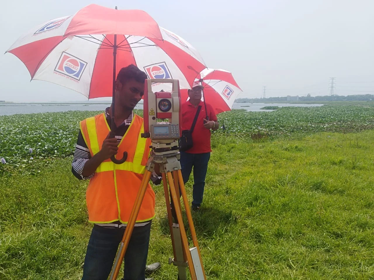
Topographic Survey:
In fact, it is conducted for various geological and geophysical exploration surveys such as 2D/3D Seismic surveys, Gravity surveys, geological mapping, etc.
Contour Survey:
It is conducted for land and water bodies.
Likewise, Transmission Line Survey GGPL is among quality services providers for transmission line survey company in Bangladesh and abort.
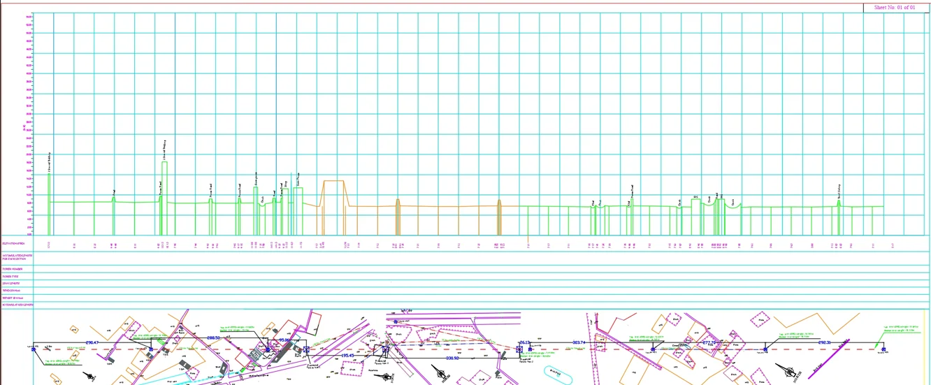
Transmission Line Contour Survey
A transmission line contour survey is an essential process in the planning and design of electrical transmission lines. This survey focuses on understanding the land’s topography, ensuring that the chosen route for the transmission line is optimal for installation and maintenance. Here are the key aspects of a transmission line contour survey:
1. Purpose
- Elevation Mapping: The survey provides detailed information about the land’s contours, which is crucial for determining the most suitable path for the transmission line.
- Obstacle Identification: It helps identify potential obstacles such as hills, valleys, and other geographic features that could affect the line’s installation and functionality.
2. Methodologies
- Survey Techniques: The contour survey often employs methods like:
- · Differential GPS: For high-accuracy location data.
- · Total Stations: To measure angles and distances with precision.
- · LiDAR Technology: For capturing detailed three-dimensional data about the terrain.
- Data Collection: Field surveys collect data that is later processed to generate contour maps, which visually represent the elevation changes across the surveyed area.
3. Environmental Considerations
- Impact Assessment: The survey assesses how the proposed route may impact local ecosystems, waterways, and land use.
- Regulatory Compliance: Ensures adherence to environmental regulations, helping to mitigate potential negative effects on the environment.
4. Applications in Engineering
- Design Guidance: The information gathered guides engineers in designing the transmission line infrastructure, including tower placements and cable routing.
- Construction Planning: Facilitates planning for access roads and logistical considerations during construction.
Conclusion
Transmission line contour surveys are vital for the effective and efficient planning of electrical transmission systems. By accurately mapping the terrain, these surveys help ensure that the infrastructure is both functional and minimally invasive to the environment.

Transmission Line Survey:
Levering on our years of experience, we hold Proficiency in offering Hi-Tension Tower Line Survey. Specifically, Proficient professionals render the service, Utilising advanced tools and technology in line with industry norms.
Furthermore, our provided service earns market acclaim due to its prompt Characteristics. Moreover, our Esteemed clients can avail this service from us at market leading prices.
Additionally, we are among the leading names in the industry conducting Transmission Lines Survey company on behalf of our esteemed customers.
We equipped with high tech machinery and vast domain experience in order to be able to provide solutions tailored to exact customer requirements. We carry out our services in compliance with the established standards.
Similarly, our focus on delivering optimum customer satisfaction. We document the results as per the customers’ detailed specification.
Additionally, we provide complete Power Transmission Line survey and structural design services. At PDCE. Moreover, we undergo training to understand, predict, and calculate the stability, strength, and rigidity of built structures for Power Transmission Lines. Likewise, Pre-Engineered Building Structure, steel Structure, Buildings and other structures, to develop designs and integrate their design with that of other designers, and to supervise construction of projects on site.
However, we provide complete and comprehensive Engineering services based on thorough investigations, analysis, design, economic consideration and functional requirements.
But also, we have extensive expertise in the design of new buildings, evaluation, renovation and repair of existing structures.
Similarly, we offer services like Structural design, Structural Peer Review in various construction projects.
Specifically, The Array our structural Designing Services encompasses Residential, Commercial, shopping mall, Institutional, Hospital, Hotel, Industrial, MS structure, bridge, road, Airport, Water Park, transmission lines, power substation Structural Designing, etc.
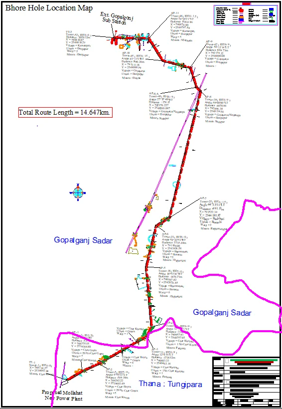
Transmission Line Topo Survey
A transmission line survey is a critical process in the planning and implementation of electrical transmission systems. This survey involves several steps and methodologies aimed at determining the optimal route for the transmission lines while considering various environmental, technical, and regulatory factors.
Key Aspects of Transmission Line Surveys:
- Objectives:
- Route Selection: Identify the most effective and safe path for the transmission lines to minimise disruption and maximise efficiency.
- Data Collection: Gather geographical and environmental data, including topography, vegetation, and existing infrastructure.
2. Survey Methods:
- Topographic Survey: This involves mapping the land’s contours and elevations using tools like GPS and total stations to create detailed terrain models.
- Environmental Impact Assessment: Evaluating how the proposed route will affect local ecosystems and communities. This includes assessing land use and compliance with environmental regulations.
3. Technologies Used:
- Geographical Information Systems (GIS): For spatial analysis and data visualisation, aiding in decision-making for route selection.
- Drones and LiDAR: These technologies can provide high-resolution data on terrain features and vegetation, enhancing the accuracy of the surveys.
4. Regulatory Compliance:
- Ensuring the survey meets local, state, and national regulations concerning land use, environmental protection, and community impact.
5. Documentation and Reporting:
- The findings of the survey are documented in detailed reports, which may include maps, photographs, and analysis of the data collected.
Determining Detailed Route through Digital Survey
The Detailed Route Survey using Digital Survey is a modern method that collects and analyses precise route information using advanced technology. It is primarily used for infrastructure projects like roads, railways, pipelines, and electrical lines. The use of digital surveys enhances speed, accuracy, and cost-efficiency.
Importance of Transmission Line Surveys:
Transmission line surveys are vital for:
- Ensuring safety and reliability in the power distribution system.
- Minimising environmental impact and facilitating compliance with regulations.
- Providing accurate data that helps engineers design effective infrastructure.
Steps of Route Determination through Digital Survey:
- Data Collection:
- LiDAR (Light Detection and Ranging): LiDAR sensors are used to collect high-resolution 3D data, which helps determine the precise terrain position and obstacle heights.
- Drones and UAVs (Unmanned Aerial Vehicles): Drones capture detailed images and videos from various altitudes to gather visual data about the route. This method enables fast and safe data collection.
- Georeferencing:
- GPS (Global Positioning System): GPS is used to accurately pinpoint locations, which serve as a foundation for mapping and planning.
- Digital Mapping: Based on the route, accurate maps are created, helping to identify key points along the route.
- Data Analysis:
- GIS (Geographic Information System): GIS analyzes geographical information and helps identify the best trace for the route, enabling easy comparison and selection of optimal routes.
- Digital Modeling: 3D models are created to analyze terrain features and other critical elements within the project area.
- Reporting and Finalization:
- A detailed report is created using the collected data, which aids in project planning and implementation.
- The digital route design acts as a guiding framework for construction.
Conclusion:
Digital route determination enhances route accuracy, making construction processes more precise and cost-effective. It plays an essential role in the planning and implementation of infrastructure projects.

