Digital Building Survey and Construction Survey:
Digital Building Survey:
The digital building survey is a modern and technology-driven surveying method that provides accurate and precise information for the design, construction, and maintenance of buildings. This method employs various digital tools and software to collect data on both the internal and external aspects of a building. It allows for the analysis of the building’s geographic condition, dimensions, and structural data.
Key aspects of the digital building survey include:
- Three-Dimensional (3D) Scanning: 3D models of buildings are created using laser scanners and drones, providing an accurate representation of the building’s design and structure.
- Accurate Measurement and Analysis: Precise measurements of each part of the building are taken, which facilitates accurate planning for design or maintenance based on this data.
- Building Information Modeling (BIM): Data about the building is digitally collected through this method and utilized in the design and construction process with the help of BIM software.
Construction Survey:
A construction survey is the process that assists in accurately determining locations, measurements, and standards at various stages of a construction project. It is essential for the timely and precise completion of the project. Construction surveys are conducted before and after the construction of land, roads, buildings, bridges, and other infrastructure.
Key aspects of the construction survey include:
- Site Layout: A site layout plan is created to establish foundations and structures in the correct locations.
- Measurement and Data Collection: Accurate measurements of land elevation, boundaries, and soil testing are conducted during the construction process.
- Quality Verification and Accuracy Assurance: Regular reviews are conducted to ensure that work is being carried out according to the design during construction.
- Cost and Timeline Determination: This survey provides information to determine the project’s costs and timelines, which is crucial for project management.
Using both digital building surveys and construction surveys together ensures accuracy, efficiency, and sustainability in a construction project.
Building Survey Equipment – Steps and Process of a Building Survey
Building Survey Equipment:
Building surveys require a variety of specialized tools and equipment to gather accurate data and information about the structure. Commonly used equipment includes:
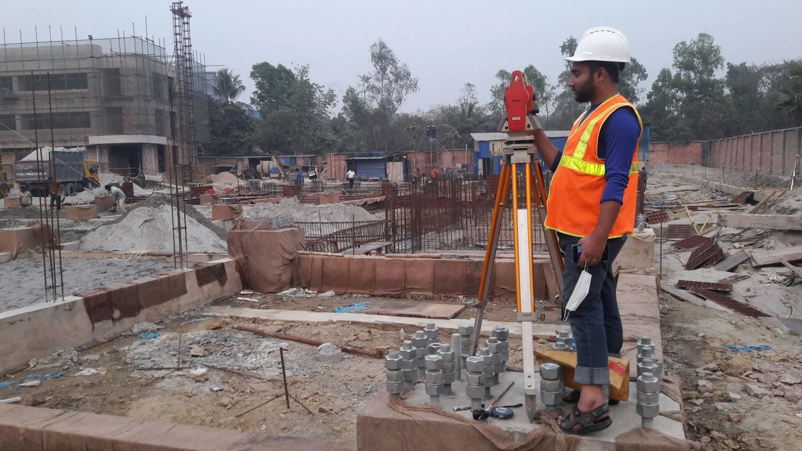
- Theodolite: Used for measuring horizontal and vertical angles, essential for accurate alignment and layout.
- Total Station: A combination of theodolite and electronic distance measurement (EDM) that provides precise measurements of distance and angles.
- Laser Scanners: Used for creating detailed 3D models of the building and capturing its geometrical features.
- GPS Equipment: Utilized for accurate geolocation data, important for site surveys and positioning.
- Digital Levels: To determine height differences and ensure horizontal alignment.
- Drones: For aerial surveys, providing a comprehensive view of the building and its surroundings.
- Measuring Tapes and Rulers: Basic tools for quick measurements of smaller distances and dimensions.
- Photogrammetry Software: Used for creating 3D models and maps from photographs taken during the survey.
Steps and Process of a Building Survey:
- Planning and Preparation:
- Define the scope of the survey and objectives.
- Gather existing information about the building (plans, previous surveys, etc.).
- Develop a detailed survey plan, including the equipment needed and the survey methods to be used.
- Site Inspection:
- Conduct a preliminary site visit to assess the condition of the building and identify any potential hazards or obstacles.
- Determine the access points and layout for conducting the survey.
- Data Collection:
- Utilize various survey equipment to collect data on the building’s dimensions, structural elements, and existing conditions.
- Capture photographs and detailed measurements of both the interior and exterior aspects of the building.
- Record data on any observed defects or areas needing further investigation.
- Data Analysis:
- Analyze the collected data to create accurate floor plans, elevations, and sections of the building.
- Use software tools to process the data and produce 3D models or Building Information Models (BIM) as required.
- Reporting:
- Compile all the findings, measurements, and analyses into a comprehensive survey report.
- Include relevant drawings, models, and photographs to support the findings.
- Provide recommendations for any repairs, modifications, or further studies needed based on the survey results.
- Review and Feedback:
- Present the survey report to stakeholders (clients, architects, engineers) for review.
- Incorporate any feedback or additional requests into the final report if necessary.
- Finalization:
- Finalize the report and distribute it to relevant parties.
- Archive all data and reports for future reference and potential follow-up surveys.

Importance of Building Surveys:
Building surveys are crucial for ensuring the structural integrity, safety, and longevity of a building. They help identify potential issues before they become major problems, provide essential information for renovations or restorations, and inform decision-making processes for property management and development.
(01) Land surveying
Additionally, A land Appraiser, also known as a Geoinformatics Appraiser and building survey. Specifically, creates site plans for construction and civil Designing projects by Gathering data and mapping the shape of the land.
Likewise, they can work on a variety of different projects including bridges, tunnels, roads, mining, and excavating among others.
Thus, some of the work they are responsible for includes:
- Geomatics – Similarly, Assembling, storing, processing, and Distributing Geoinformatics information
- Feasibility studies – However, carrying our surveys and Evaluations on potential construction sites
- Geomechanics – monitoring land movement and Sinking caused naturally or during the construction process
- Geospatial Evaluation – Furthermore, Mapping exact Location data of site Characteristics using GPS and Measuring Equipment. Likewise, mapping land use with satellite Imaging, and producing digital images.

Building Condition Survey
A Building Condition Survey is a detailed review and assessment process aimed at evaluating the structural and functional condition of a building. The main purpose of this survey is to ensure the stability, safety, and long-term functionality of the building. It plays a crucial role in making informed decisions regarding repairs, maintenance, and rehabilitation of the structure.
Key Aspects of a Building Condition Survey:
- Structural Assessment:
- The condition of the building’s walls, roof, floors, columns, and beams is evaluated.
- Cracks, corrosion, water damage, or any structural defects are identified.
- The strength and condition of construction materials like bricks, concrete, and steel are assessed.
- External Evaluation:
- The external walls, roof, windows, doors, and facade of the building are inspected.
- Weathering effects or any external factors such as water damage or moisture issues are identified.
- Internal Evaluation:
- The internal condition of walls, ceilings, floors, windows, and doors is observed.
- Any signs of dampness, mold, or cracks that could cause internal damage are identified.
- Electrical and Mechanical Systems Review:
- The electrical systems, including wiring, circuit breakers, and lighting, are inspected.
- Plumbing, HVAC (Heating, Ventilation, and Air Conditioning), and piping systems are checked for functionality.
- Fire Safety Systems:
- Fire extinguishing systems, smoke evacuation systems, and emergency exit routes are assessed for functionality.
- Compliance with fire-resistant construction materials and safety regulations is verified.
- Safety Measures:
- The condition of staircases, balconies, railings, and other safety equipment is evaluated.
- The security of entry and exit points in the building is reviewed.
- Water Drainage and Moisture Control:
- The drainage system and pathways for water removal from the roof are inspected.
- The presence of moisture and its potential to cause damage is assessed.
- Maintenance Evaluation:
- Regular maintenance activities of the building and future repair or renovation plans are reviewed.
- Problems arising from poor maintenance or irregular upkeep are identified.

Steps in a Building Condition Survey:
- Preliminary Preparation:
- Collect building designs, plans, and previous survey reports.
- Prepare the necessary tools and define the survey timeline.
- Site Inspection:
- Conduct a physical site visit to observe and collect data on different parts of the building.
- Use necessary equipment such as theodolites, leveling instruments, and laser scanners.
- Data Collection and Analysis:
- Gather data on the structure, electrical and mechanical systems, and safety measures of the building.
- Analyze the data to create a clear picture of the current condition of the building.
- Report Preparation:
- Compile all the collected data into a detailed report.
- The report includes identified issues, suggested solutions, and maintenance or repair plans.
- Recommendations and Suggestions:
- Provide recommendations for building repair, maintenance, or improvement.
- Plan for future actions to ensure the building’s durability and safety.
Importance of a Building Condition Survey:
- Ensures the safety of the building.
- Maintains structural stability and functionality.
- Identifies potential defects and issues early, preventing larger damages in the future.
- Helps control maintenance costs and prepare necessary repair plans.
- Provides accurate information for future property valuation and improvement.
This survey is essential for evaluating a building’s current state and planning for future developments.
(02) Building condition survey
- However, A Building survey advise clients about the design and construction of new buildings.
- They need to have good communication and problem-solving skills. Likewise, some of the work involved includes:
01. Make sure that properties meet building regulations and fire safety accessibility standards.
02. Dealing with planning applications.
03. Surveying properties to identify structural faults and making recommendations for repairs.
(03) Technical surveying
A Technical surveyors carry out various tasks, most of them in support of architects-chartered surveyors, and engineers.
Their duties include:
- Droughting plans using computer software
- Helping with environmental impact assessments
- Supervising construction operatives at site
(04) Planning and development surveyor
Likewise, A building survey planning and development surveyor’s main role is to assess, design, and manage development projects.
- Thus projects can be varied and planning and development the surveyor would be involved in every stage of the project from initial site assessments to the completion of the entire project as a result.
Moreover, the role of a planning and development surveyor would include:
- Assessing whether plans are workable
- Assisting on planning applications

Service Description of Building Survey Report
Additionally, our experts are using reflector less total station and handheld lasers therefore they can observe measurements quickly and accurately. Likewise With the horizontal and vertical data from these measurements. Similarly, they can accurately generate floor plans and building cross-sections.
But also, our surveyors are specialized in high detail fade surveys. Moreover, to illustrate totalize our building survey and to provide enhanced visualization we apply a range of techniques. Furthermore, SBSC team is familiar with terrestrial photogram metrical methods for 3-dimensional data capture. Our lab is enriched with a range of updated software so we can ensure proper digital visualization and output as a result.

