As a drone surveyor, you’ll capture high-accuracy aerial data using drones equipped with downward-facing sensors, such as RGB or multispectral cameras and LIDAR payloads. Each flight can produce thousands of measurements, represented in various formats, like orthomosaics, point clouds, and contour lines. Factors like drone type, camera resolution, flight height, vegetation, and geolocation technology influence the accuracy of the captured data. You’ll achieve absolute accuracy down to 1 cm (0.4 in) under ideal conditions. Discover how you can efficiently collect data, boost workflow efficiency, and create accurate 2D and 3D models, and get ready to harness the full potential of drone surveying.
Capturing Aerial Data With Drones
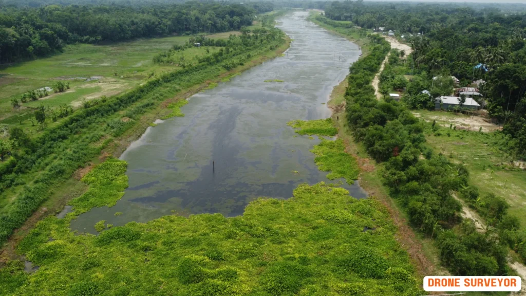
When you deploy drones for aerial data capture, you’re leveraging unmanned aerial vehicles (UAVs) equipped with downward-facing sensors, such as RGB or multispectral cameras, and LIDAR payloads to collect data from the air.
As a drone surveyor, you’re aiming to generate high-resolution, high-accuracy data quickly and cost-effectively. With drones, you can capture data from a lower altitude, covering hundreds of hectares in just a few flights. Capturing Aerial Data requires :
- Drone Equipment: UAVs equipped with downward-facing sensors like RGB or multispectral cameras and LIDAR payloads.
- Efficiency: Capture data from lower altitudes, covering extensive areas efficiently.
- Data Formats: Each flight generates thousands of measurements represented in orthomosaics, point clouds, DTMs, DSMs, and contour lines.
- Accuracy Factors: Accuracy depends on drone type, camera resolution, flight height, vegetation, and geolocation technology.
- High-end Accuracy: High-end surveying drones like WingtraOne can achieve absolute accuracy down to 1 cm (0.4 in) under ideal conditions.
Land Surveying Key Benefits
By integrating drone surveyor’s drones into your workflow, you can substantially boost the efficiency of data collection.
- Efficiency: Significantly enhances data collection efficiency.
- Reality Models: Quickly create reality models including plots and attachments.
- Real-time Visualization: Generate 2D orthomosaics in real-time to visualize land cover and identify changes.
- Large Area Mapping: Enable rapid mapping and modeling of large areas, producing accurate 2D and 3D models.
- Speed: Improve data collection and processing efficiency up to tenfold.
- Project Lifecycles: Obtain deliverables quickly, shortening project lifecycles.
- Standard Outputs: Provide industry-standard outputs including DOM, DSM, and 3D reality models.
Cadastral Surveying With Drones
By leveraging drone technology in cadastral surveying, you can overcome traditional surveying limitations and efficiently map property boundaries, empowering you to make more informed decisions.
With drones, you can generate 1:500 scale maps without using Ground Control Points (GCPs) while meeting centimeter-level accuracy requirements, making drone surveying more efficient.
This efficiency is further amplified as you can improve data collection and processing up to 10 times, acquiring deliverables quickly and shortening project lifecycles.
As a cadastral surveyor, you can operate multiple drones with a single remote controller, covering large areas quickly and reducing the need for multiple teams.
This means you can work more efficiently, reducing project timelines and costs.
The data collected from drone surveyor provides accurate and detailed information, including 2D orthomosaics and 3D models, helping you visualize property or lot boundaries and identify changes.
With drone surveyor’s technology, you can make more accurate assessments and informed decisions, ultimately leading to better outcomes in cadastral surveying projects.
Managing Land-cover and Land-use
You can effectively manage land-cover and land-use changes by leveraging drone surveying technology, which provides accurate and up-to-date data, enabling you to make informed decisions.
Unlike satellite data, which is expensive and limited in resolution and accuracy, drones offer a more efficient solution.
Traditional fieldwork methods, such as using total stations and handheld RTK devices, are slow and inefficient compared to drones, which can quickly cover large areas and provide accurate data.
With drone surveyor technology, you can visualize results quickly using real-time 2D orthomosaics or create accurate, high-resolution maps in post-processing.
This automation substantially reduces costs, making land-cover and land-use management more efficient.
Additionally, you can keep digital records that can be easily used for regular land cover comparisons, monitoring changes dynamically with drone-based land surveying.
Topographic Surveys by Drones
Drones are revolutionizing topographic surveys by rapidly creating accurate reality models that include plots and attachments, substantially reducing project timelines and costs compared to traditional surveying methods.
You can now generate 2D orthomosaics in real-time to visualize land cover and identify changes, improving the efficiency of data collection and processing up to 10 times.
By operating multiple drones with a single remote controller, you can cover large areas quickly, increasing efficiency of data collection and processing up to 10 times.
This allows you to map and model large areas quickly, producing data for accurate 2D and 3D models, and notably reducing project lifecycles.
Furthermore, you can generate 1:500 scale maps without using Ground Control Points (GCPs) while meeting centimeter-level accuracy requirements, providing industry-standard outputs like DOM, DSM, 3D reality models, and more.
With drone-based topographic surveys, you can achieve high-accuracy results while reducing project timelines and costs substantially.
Benefits of Drone Surveying
Drone surveying offers a significant advantage from a temporal and financial perspective, capturing topographic data up to five times faster than traditional land-based methods.
- Speed and Cost: Capture topographic data up to five times faster than traditional methods.
- Cost Reduction: Reduce field time and survey costs, allowing for faster, cost-effective survey results.
- Inaccessible Areas: Map otherwise inaccessible areas, eliminating the need to close highways or train tracks.
- Detailed Data: One drone flight produces thousands of measurements in various formats, enabling informed decision-making.
Types of Drone Survey Data
Beyond the temporal and financial benefits, the versatility of drone surveying lies in its ability to deliver a wide range of mapping data, each providing unique insights into the surveyed area.
As a surveyer, you can choose from various data types, each suited to your specific needs.
- Versatility: Deliver a wide range of mapping data, each providing unique insights.
- Orthomosaic Maps: High-resolution, 2D representation of land, similar to satellite view.
- 3D Models: Generated using drone footage from multiple angles for accurate measurements and visualizations.
- LiDAR Data: Suitable for mapping areas with obstacles or in low-light conditions.
- Multispectral Maps: Valuable for vegetation health, soil moisture, and other environmental factors.
Drone Survey Accuracy and Limitations
Achieving accurate results in drone surveying relies heavily on understanding the factors that influence the precision of your data, including ground sampling distance, camera resolution, and flight height.
The type of drone, camera resolution, and flight height all impact the accuracy of your survey. For instance, high-end surveying drones like WingtraOne can achieve absolute accuracy down to 1 cm (0.4 in) under ideal conditions.
You’ll also need to take into account vegetation, geolocation technology, weather, and restricted areas, as these can affect your results.
When processing images with photogrammetry software, you can create detailed 2D and 3D maps, extracting information like distances and volumetric measurements.
However, this method may not be suitable for small-scale projects or in bad weather conditions.
Grasping the difference between absolute accuracy (comparing your map to the real landscape) and relative accuracy (ensuring consistency within your map) is crucial.
Best Drones for Surveying Purposes
When selecting a drone for surveying purposes, you’ll want to evaluate models that offer high-accuracy image and Lidar data capture;
- DJI Matrice 300 RTK: High-accuracy image and Lidar data capture.
- Phantom 4 RTK: Intuitive solution for centimeter-level accurate data and georeferenced 2D maps and 3D models.
- eBee X: Fixed-wing drone for large-scale mapping projects, covering up to 1,200 acres in a single flight.
- WingtraOne: Achieves absolute accuracy down to 1 cm (0.4 in) under ideal conditions.
- P4 Multispectral: Captures centimeter-level accurate data and creates vegetation index maps for environmental monitoring.
Processing Drone Survey Data
With your drone survey mission complete, you’re now left with a memory card filled with geotagged images, ready to be processed into actionable data.
The geographical information (X, Y, Z) embedded in each image is vital for accurate processing. Geo-tagging software like WingtraHub assigns precise geographical positions to each image, ensuring seamless data integration.
Next, photogrammetry software takes over, stitching the images into orthomosaics and 3D models. These outputs enable you to extract valuable information, such as precise distance, surface, and volume measurements.
These metrics are essential for tracking site changes and managing projects effectively. Depending on your specific needs, you may opt for LIDAR or photogrammetry technology.
While LIDAR excels in high-accuracy applications, photogrammetry is better suited for large-area coverage. By leveraging these technologies, you’ll tap the full potential of your drone survey data, gaining actionable insights to drive informed decisions.
Frequently Asked Questions
Q: What is a drone surveyor and what role do they play in surveying with a drone?
A: A drone surveyor is a professional who utilizes drones to collect and analyze data for surveying purposes. They are responsible for planning and executing survey flights, managing drone pilots, and processing the drone imagery to create detailed 3D models and high-resolution maps of the surveyed area.
Q: What types of drones are commonly used by surveyors for aerial surveys?
A: Common drones used in surveying include fixed-wing VTOL (Vertical Take-Off and Landing) UAVs, multirotor drones, and specialized drones designed for photogrammetry. These drones can fly quickly and easily over large areas, capturing high-resolution images for analysis.
Q: How does photogrammetry enhance the capabilities of a drone surveyor?
A: Photogrammetry enhances the capabilities of a drone surveyor by allowing them to generate detailed 3D models and maps from the drone images taken during survey flights. This technology enables the surveyor to analyze and interpret spatial data with high accuracy, which is essential for construction projects and land assessments.
Q: What is the significance of PPK technology in drone surveying?
A: PPK (Post-Processed Kinematics) technology is significant in drone surveying as it ensures the highest accuracy in the positioning data collected during the survey flight. This technology allows surveyors to correct GPS data after the flight, resulting in highly accurate geospatial information crucial for various surveying applications.
Q: Can a drone surveyor perform site surveys for construction projects?
A: Yes, a drone pilot can perform site surveys for construction projects. Using drones equipped with appropriate survey equipment and software, they can efficiently collect data, take aerial photos, and generate accurate models of the construction site, which aids in planning and monitoring progress.
Q: What file formats are typically used to store the data generated by drones in surveying?
A: The data generated by drones in surveying is typically stored in various file formats, including TIFF for images, LAS for point cloud data, and GeoJSON for geospatial data. These formats are compatible with most surveying software and platforms, making them easy to analyze and share.
Q: How can surveying software improve the efficiency of a drone surveyor?
A: Surveying software improves the efficiency of a drone surveyor by providing tools for planning survey flights, processing drone imagery, and analyzing data. It streamlines the workflow, allowing surveyors to quickly and easily coordinate their projects and produce accurate results.
Q: What are the benefits of using drones for stockpile management in construction projects?
A: The benefits of using drones for stockpile management include the ability to quickly and easily measure stockpile volumes, monitor changes over time, and generate detailed reports based on high-resolution drone imagery. This utility enhances decision-making and resource management in construction projects.
Q: What should I consider when hiring a drone surveyor for my project?
A: When hiring a drone surveyor, consider their experience, the types of drones used, the technology they employ (such as PPK), and their ability to provide high-resolution imagery and detailed models. Additionally, ensure they are familiar with the surveying software needed for your specific project requirements.
Conclusion
As you wrap up your drone surveying project, you’ve accessed a treasure trove of precise data, revolutionizing the way you capture aerial insights.
With cadastral surveys, topographic maps, and land-cover analysis, you’ve transformed the surveying landscape.
But, be aware, the real magic happens when you merge drone data with advanced analytics, harnessing a data-driven powerhouse that redefines the surveying industry.
Now, take your project to the next level by contacting Sonar Bangla Survey Consultants at +880 1742 585592 to get a free quotation and experience the expertise of a professional team with over 150 5-star reviews on Google.