As a land surveyor, you rely on precise measurements to get the job done. That’s where land survey total stations come in – integrating theodolite, electronic distance measurement, and microprocessor functions for enhanced accuracy and speed. You’ll capture detailed topographic data, including angles, distances, and heights, with ease. Advanced features enable precise data collection, ensuring reliable measurements. From infrastructure projects to environmental monitoring, land survey total stations are essential tools. Now, explore the principles, applications, and benefits of land survey total stations to take your surveying skills to the next level.
Understanding Land Survey Total Station Technology
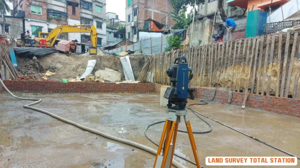
You operate a land survey total station, a sophisticated electronic instrument that integrates the functions of a theodolite, electronic distance measurement (EDM), and a microprocessor to perform complex surveying tasks with enhanced accuracy and speed.
This cutting-edge technology enables you to tackle challenging land survey projects with confidence.
As a surveyor, you rely on the land survey total station’s advanced features to collect precise data, ensuring that your measurements are reliable and accurate.
When conducting a road survey using a land survey total station, you can capture detailed topographic data, including angles, distances, and heights, with ease.
The instrument’s microprocessor quickly processes the data, providing you with instant calculations and reducing errors.
With a land survey total station, you can efficiently collect and analyze data, ultimately producing high-quality surveys that meet the demands of modern infrastructure projects. Benefits are:
- Enhanced Accuracy: Tackles challenging land survey projects with confidence.
- Data Collection: Collects precise data for reliable and accurate measurements.
- Topographic Data: Captures detailed topographic data, including angles, distances, and heights.
- Instant Calculations: The microprocessor quickly processes data, reducing errors.
- Efficiency: Produces high-quality surveys that meet modern infrastructure project demands.
Principles of Total Station Measurement
Measuring distances with a land survey total station involves sending out a laser beam and calculating the time it takes to be reflected back, allowing for accurate calculations with a precision of about 1.5 millimeters plus two parts per million.
This process enables you to determine the distance to your target with remarkable accuracy :
- Distance Measurement: Accurate calculations to determine target distance.
- Angle Measurement: Measures angles with an accuracy within a standard deviation of 0.5 arc-seconds.
- Efficiency: Combines theodolite, auto level, and electronic distance meter functions.
- Data Management: Electronically gathers data for computer processing.
- Automation: Advanced models automate target aiming and measurement, saving time.
Applications in Land Surveying
With their high accuracy and efficiency, land survey total stations have become an indispensable tool in various land surveying applications, ranging from topographic surveys to deformation monitoring.
- Infrastructure Projects: Highway and railway construction requiring precise measurements.
- Topographic Surveys: Create detailed 3D models for accurate mapping and planning.
- Deformation Monitoring: Tracks movements in structures like bridges, dams, and high-rise buildings.
- Mining and Excavation: Tracks volumes and movements of materials.
- Environmental Monitoring: Tracks coastal erosion or landslides.
- Precision Agriculture: Optimizes crop yields and reduces waste.
Types of Total Stations Explained
Land survey total stations are categorized into distinct types, each designed to cater to specific surveying needs and project requirements.
Manual Total Stations: Require direct operation, suitable for small-scale projects with limited budgets.
Robotic Total Stations: Controlled remotely, ideal for large-scale projects requiring speed and accuracy.
Reflectorless Total Stations: Use a visible red laser beam to measure distances.
Prism-Based Total Stations: Rely on a 360-degree prism to reflect the laser beam.
3D Total Stations: Measure angles and distances in three dimensions for detailed data capture.
Benefits of Using Total Stations
You’ll reap numerous benefits by incorporating total stations into your land surveying workflow, including enhanced accuracy, improved efficiency, and reduced costs.
- Enhanced Accuracy: Minimizes the risk of human error, ensuring reliable data.
- Efficiency: Processes data in real-time, allowing for quick decision-making.
- Cost Reduction: Reduces the need for rework and revisits, saving time and money.
- Portability: Designed to be portable and rugged, suitable for challenging environments.
Choosing the Right Total Station
Considering your project’s unique demands, budget constraints, and operator expertise is essential when selecting the most suitable land survey total station for your land surveying needs.
You’ll want to determine the type of project you’re working on, the size of the area to be surveyed, and the level of accuracy required.
For large-scale projects that require speed and accuracy, robotic land survey total stations are ideal. However, if you’re working on a small-scale project with a limited budget, a manual total station might be a more cost-effective option.
When choosing a land survey total station, consider the range you need.
Some models can measure distances up to 1,500 meters with an accuracy of about 1.5 millimeters ± 2 parts per million.
You’ll also want to think about the type of prism or reflector you’ll be using, as a 360-degree prism will provide more accurate readings than smaller prisms.
Finally, consider the level of automation and motorization you need.
Fully robotic land survey total stations allow for remote operation and one-man operation, making them more efficient.
Advancements in Total Station Technology
Recent breakthroughs in land survey total station technology have revolutionized the land surveying industry, revealing unprecedented levels of efficiency, accuracy, and convenience.
You can now enjoy the benefits of reflectorless total stations, which can measure distances up to 1,500 meters without the need for a prism or reflector. This innovation enables you to work more efficiently and safely, especially in areas with restricted access.
Robotics has also made a significant impact on total station technology. With robotic total stations, you can automatically find and focus on targets, saving time and labor costs.
Additionally, modern total stations now come equipped with integrated GNSS (Global Navigation Satellite System) capabilities, allowing you to determine your precise location and orientation in the field.
The latest advancements have also brought improved accuracy, with some instruments capable of measuring angles within a standard deviation of 0.5 arc-seconds.
Furthermore, you can now transfer data seamlessly between your total station and computer or mobile device via Bluetooth and Wi-Fi connectivity.
These advancements have transformed the land surveying industry, making your job easier, faster, and more accurate.
Frequently Asked Questions
Q: What is a robotic total station?
A: A robotic total station is an advanced surveying instrument that integrates the functionality of a total station with robotic capabilities. This allows for remote control operation, enabling surveyors to collect data efficiently without the need for a second person on site.
Q: How does a Leica total station compare to other brands?
A: Leica total stations are renowned for their precision and reliability. They often feature advanced technology, excellent data storage capabilities, and user-friendly interfaces, making them a preferred choice among professionals in the surveying industry.
Q: What is the primary function of a total station?
A: The primary function of a total station is to measure horizontal and vertical angles as well as distances from the instrument to various points. This data is essential for creating accurate survey maps and coordinating construction projects.
Q: Can a total station be used for 3D scanning?
A: Yes, many total stations are capable of scanning and collecting 3D data. This functionality enhances the overall surveying process by providing detailed spatial information and enabling more complex data analysis.
Q: How do you calculate coordinates using a total station?
A: To calculate coordinates using a total station, surveyors measure the horizontal and vertical angles and the distance from the instrument to the target point. This data is then processed using trigonometric principles to derive the coordinates of the point in the specified reference frame.
Q: What are the advantages of using a robotic total station?
A: The advantages of using a robotic total station include increased efficiency due to remote control operation, reduced manpower requirements, and the ability to quickly and accurately take measurements over greater distances without the need for line of sight adjustments.
Q: What types of data can be collected with a total station?
A: Total stations can collect various types of data, including distance measurements, angle measurements, and elevation data. This data can be stored for later analysis or used in real-time for immediate decision-making in surveying projects.
Q: How does a total station eliminate the need for traditional theodolites?
A: Total stations combine the functionality of a theodolite with electronic distance measurement, thus eliminating the need for separate instruments. This integration allows for faster and more accurate data collection while simplifying the surveying process.
Q: What is the best total station for beginners?
A: The best total station for beginners typically includes user-friendly features, comprehensive manuals, and robust customer support. Devices from reputable brands such as Leica are often recommended due to their intuitive designs and reliable performance.
Conclusion
As you stand on the vast, open landscape, total station in hand, the precision and power of this technology is palpable.
Yet, in the midst of this modern marvel, it’s easy to forget the laborious, painstaking surveys of the past. The contrast is stark: from tedious, manual calculations to instantaneous, accurate readings.
With total stations, the art of land surveying has evolved, and you’re at the forefront of this revolution.
For a professional and accurate land survey experience, call Sonar Bangla Survey Consultants office at +880 1742 585592 to get a free quotation.
With over 150 5-star reviews on Google, you can trust our expertise to deliver exceptional results.